Archive | Domino RSS feed for this section

DOMINO 20 2017-01-13 17:44:00

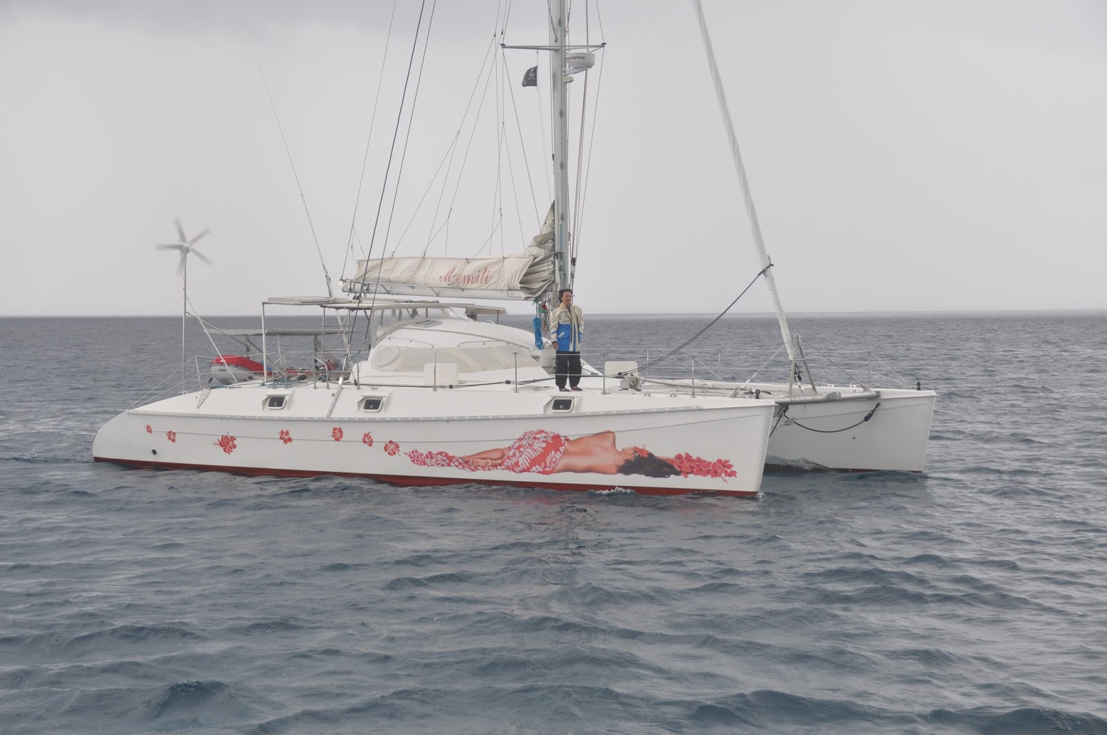
NEW CALEDONIA  –  The Great North

October 2016
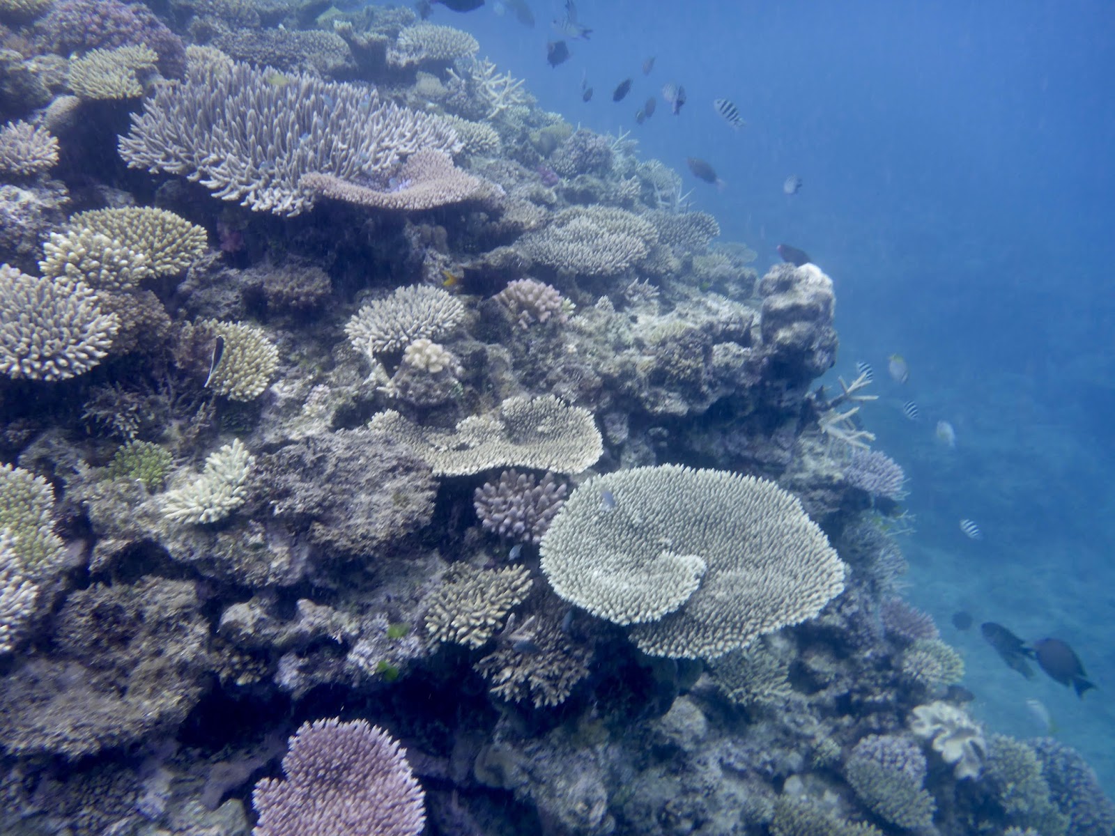
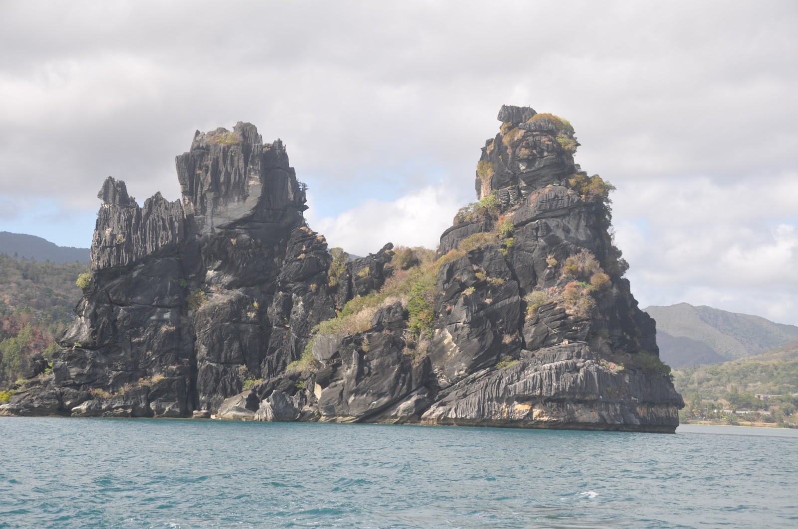
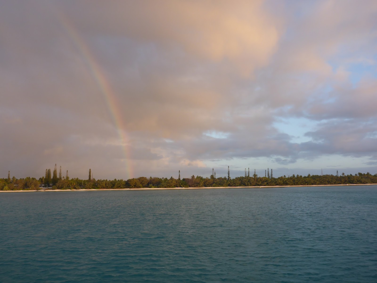
The Great North Reef at Ile Pott
We had been advised not to cruise the Great North, supposed to be a cradle of violent independentists.  But the lagoon looked too stunning and we just ignored that warning.  In each village, we took care of presenting the “Coutume,” ask for permission to cruise, snorkel, hunt and fish, and we took care to meet the locals.

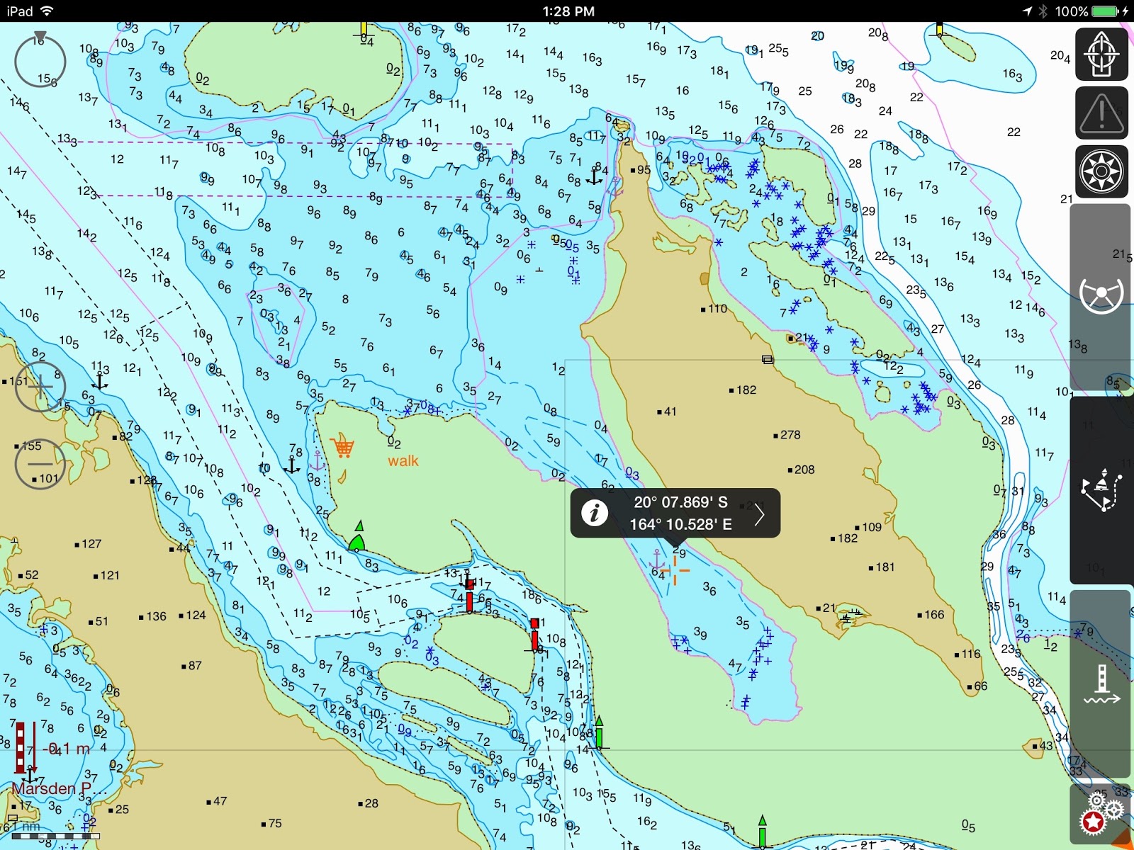
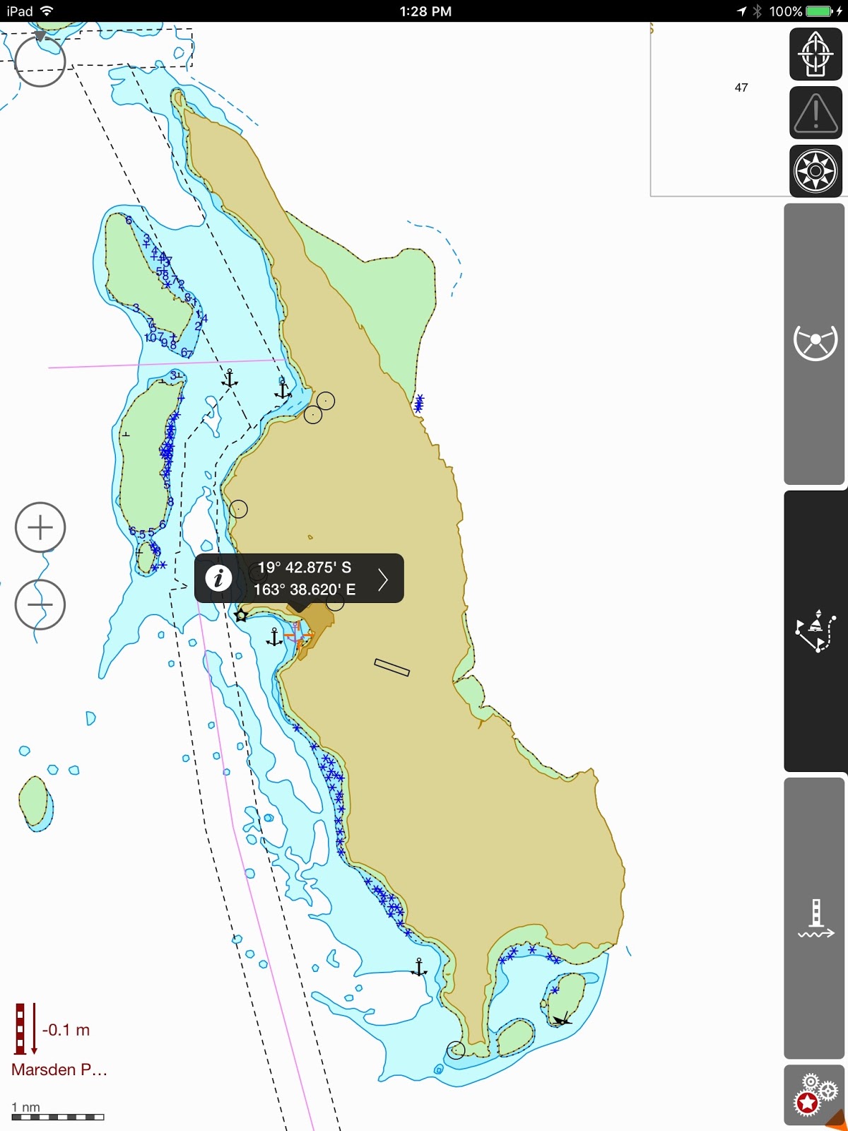
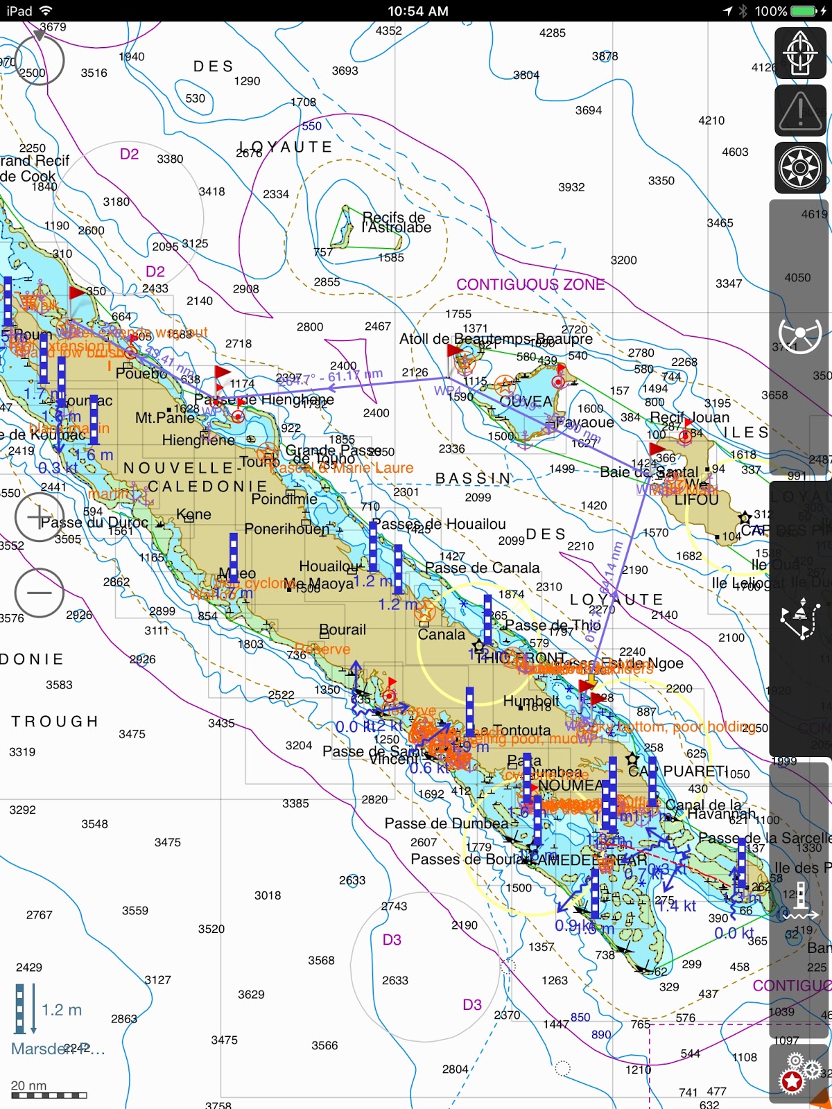
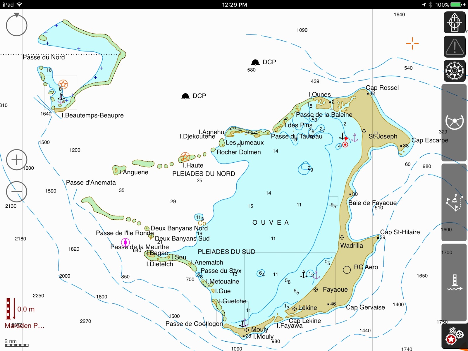
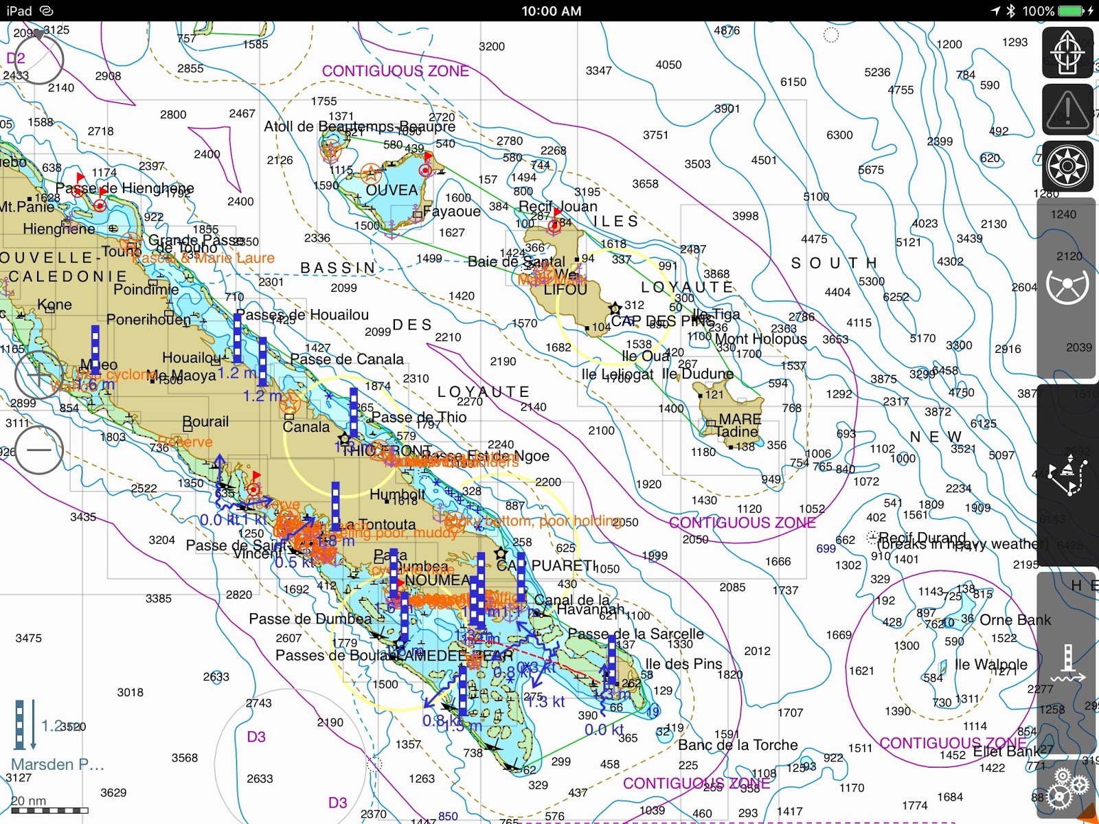
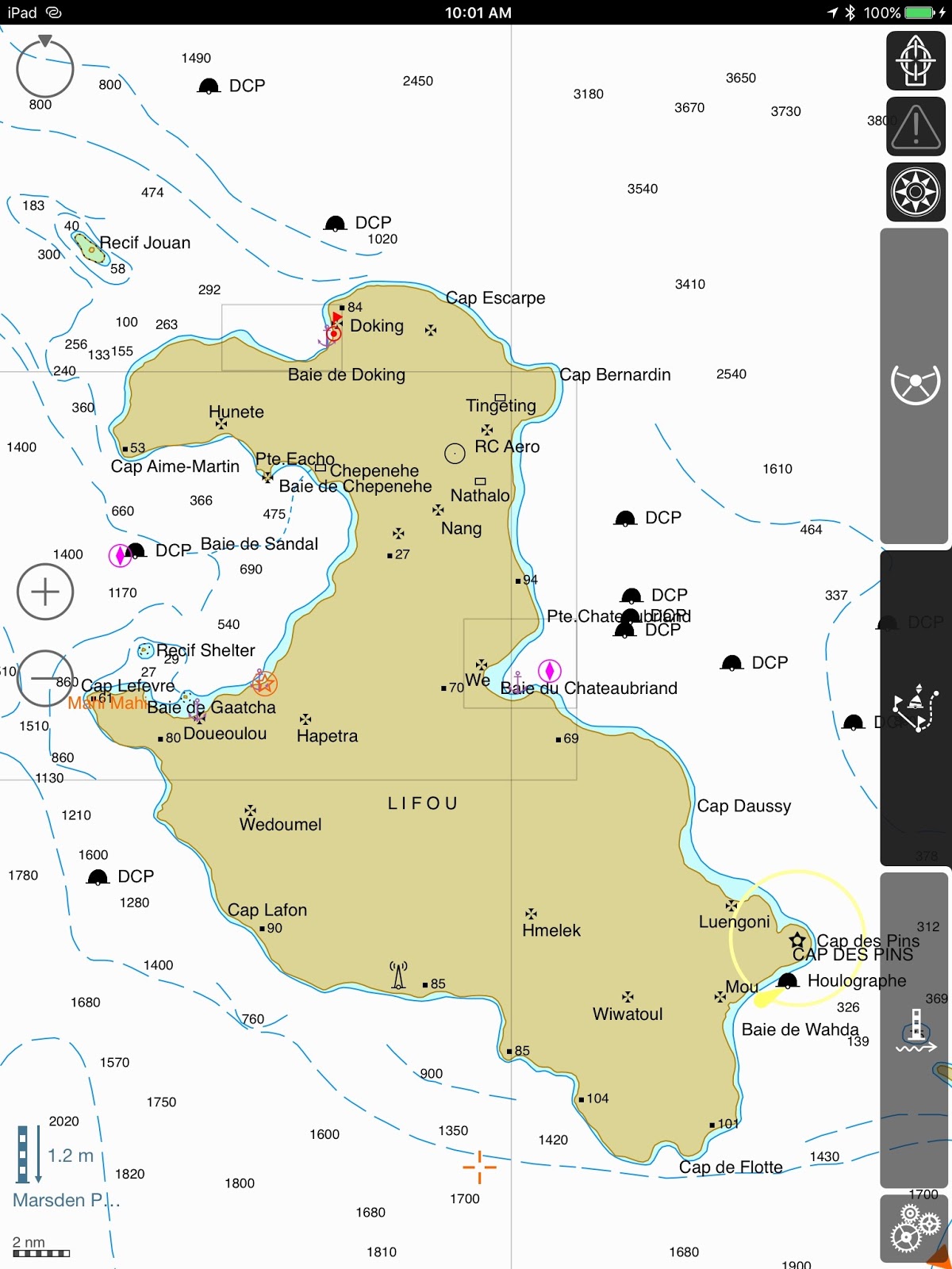
Our Great North Circuit:  from Baie de Pam to Balabio and the Beleps (Ile Art, Ile Pott)
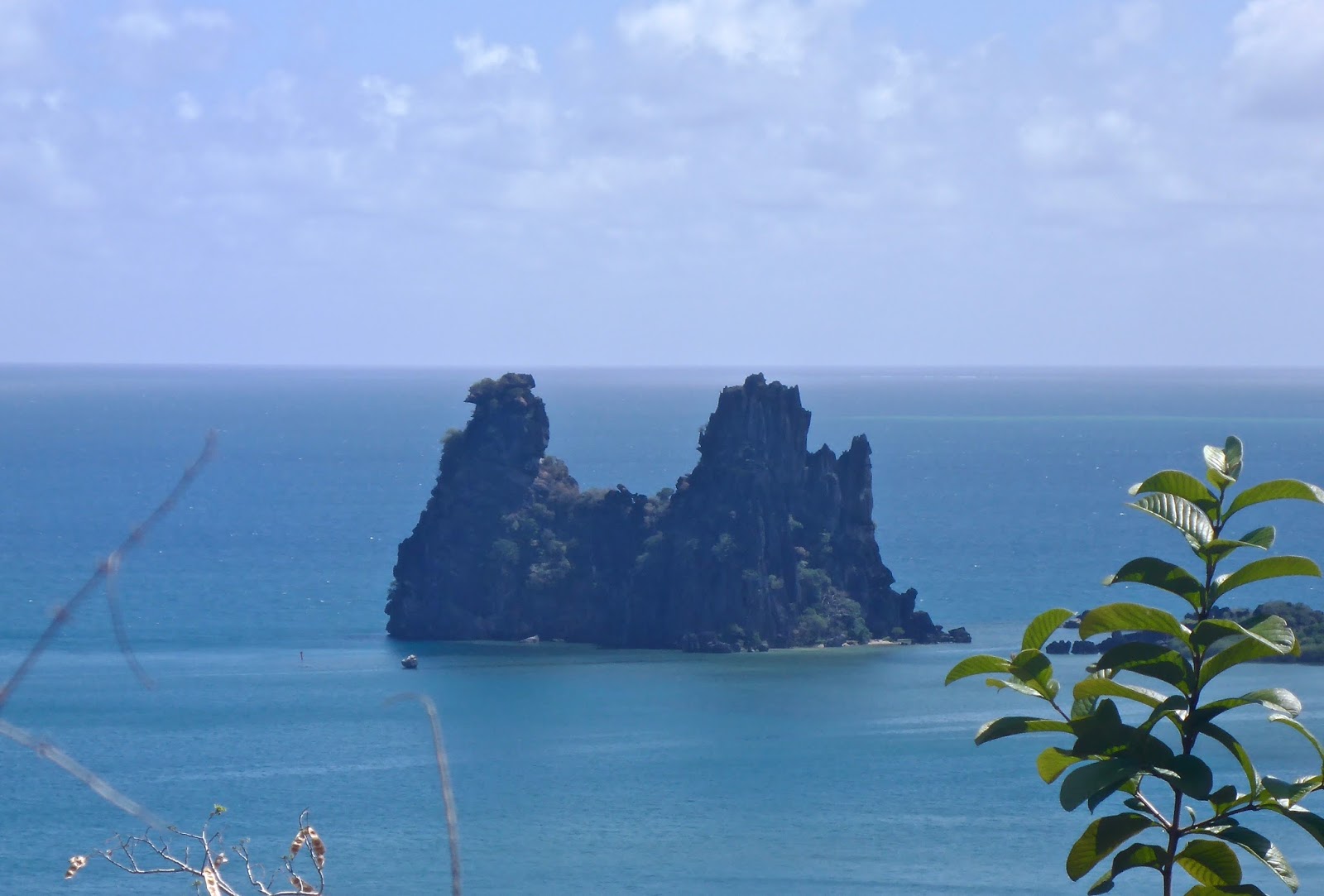
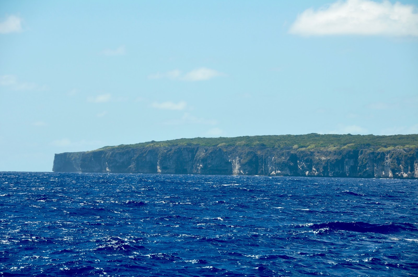
Balabio Reef and Island 

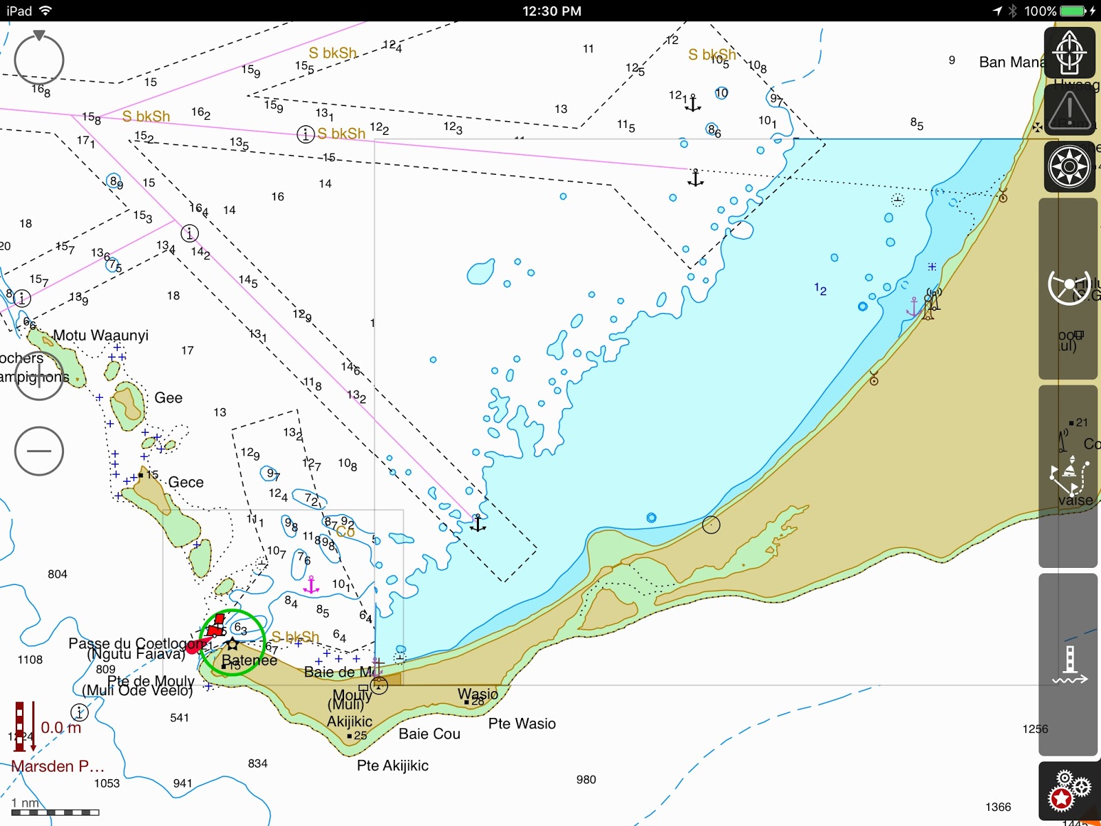
1st stop: BALABIO – 20*03.500S – 164*09.800E
–  The Balabio Reef is extensive.  Our friends Serge & Joann (S/V “Spirare”) had advised us to anchor west of the Ilots Saint-Phalle (20*06.632S – 164*06.239E) and walk the reef at low tide, but the tide was not with us: high at mid-day, the tide would be low by late afternoon and there was no way we were going to anchor in such an exposed area and walk the reef at night.  We had to pass on this excellent stop.

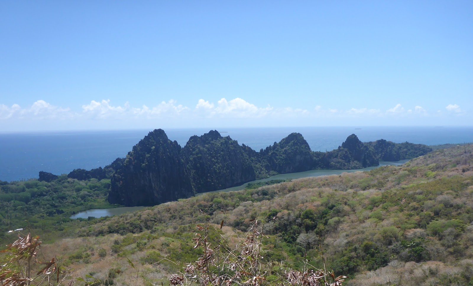
Between Balabio and the Beleps: The Daos

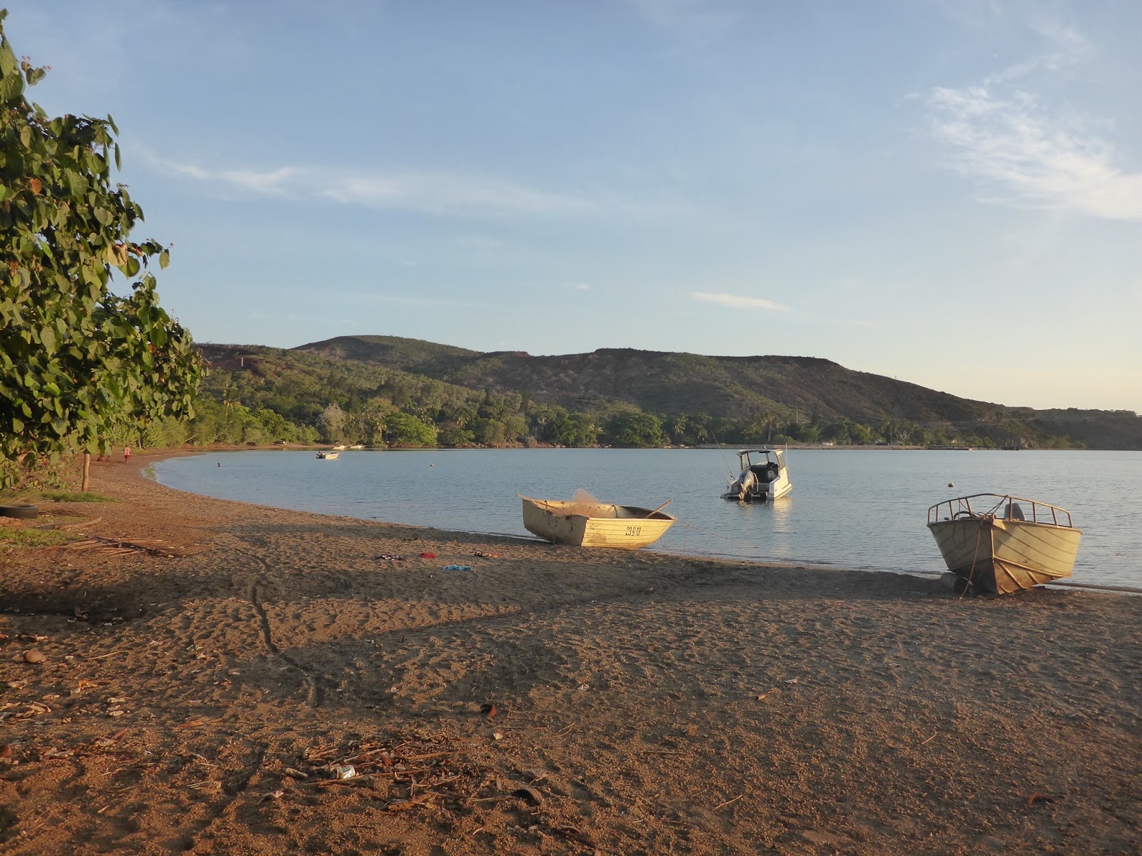
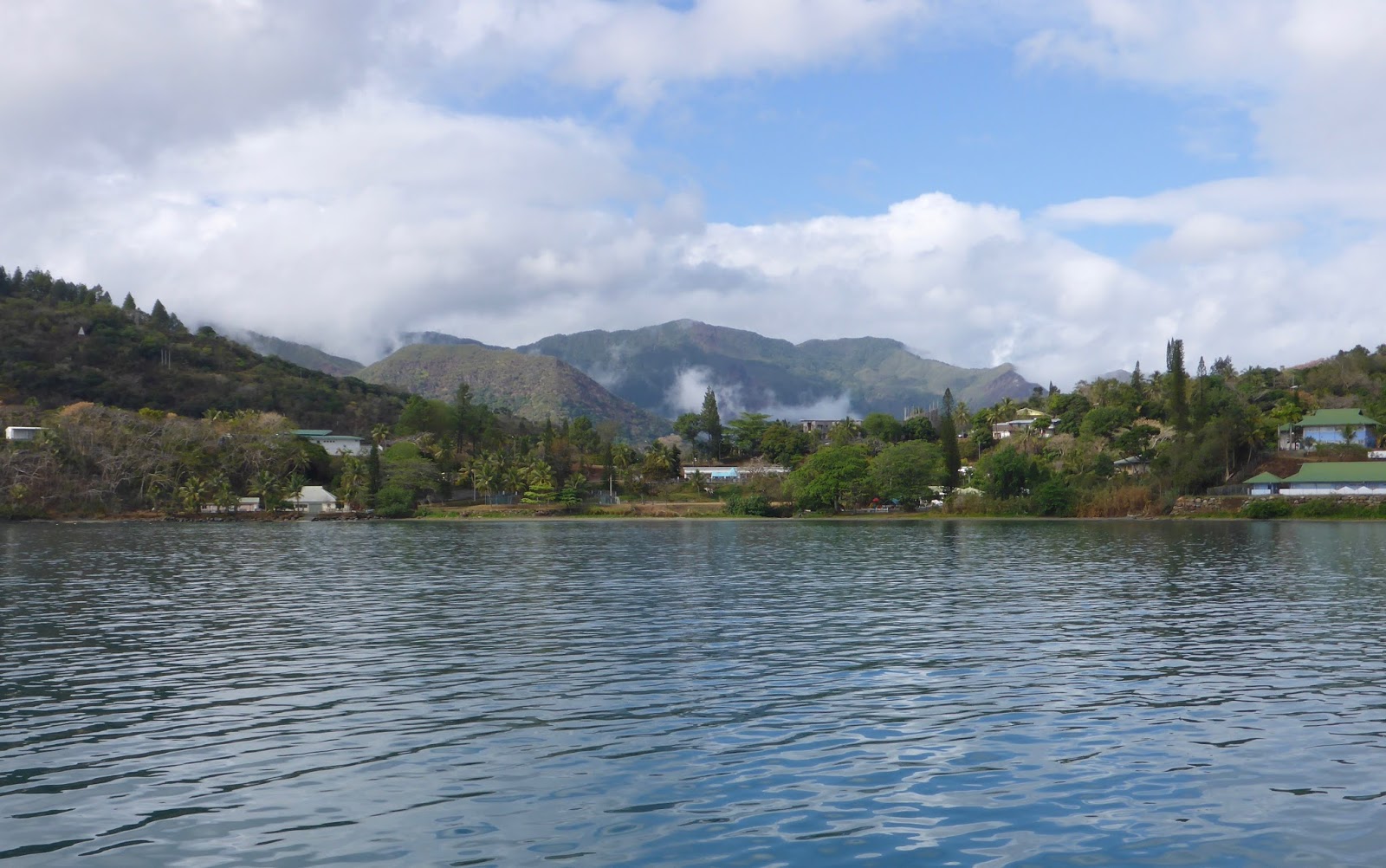
Instead, we proceeded directly to Fine Bay and anchored easily in 7 meters of water over sand.  SAND!  Blue water!  At last… Quick in the water!!!

The reef is quite beat-up and home to big jellyfish (rather inoffensive)
whose large white disks dot the way into Balabio

The reef on the north end of the bay was a bit beaten up, still it was lovely to snorkel amid anemones, find giant clams again, spot a few spiny lobsters and look for the little creatures between the rocky crags.  On shore, though, is where we were blown away by the geology.  Quartz in all colors, mauve, orange, purple; amorphous glass; so many pretty granites that I wanted to load and bring on board!  

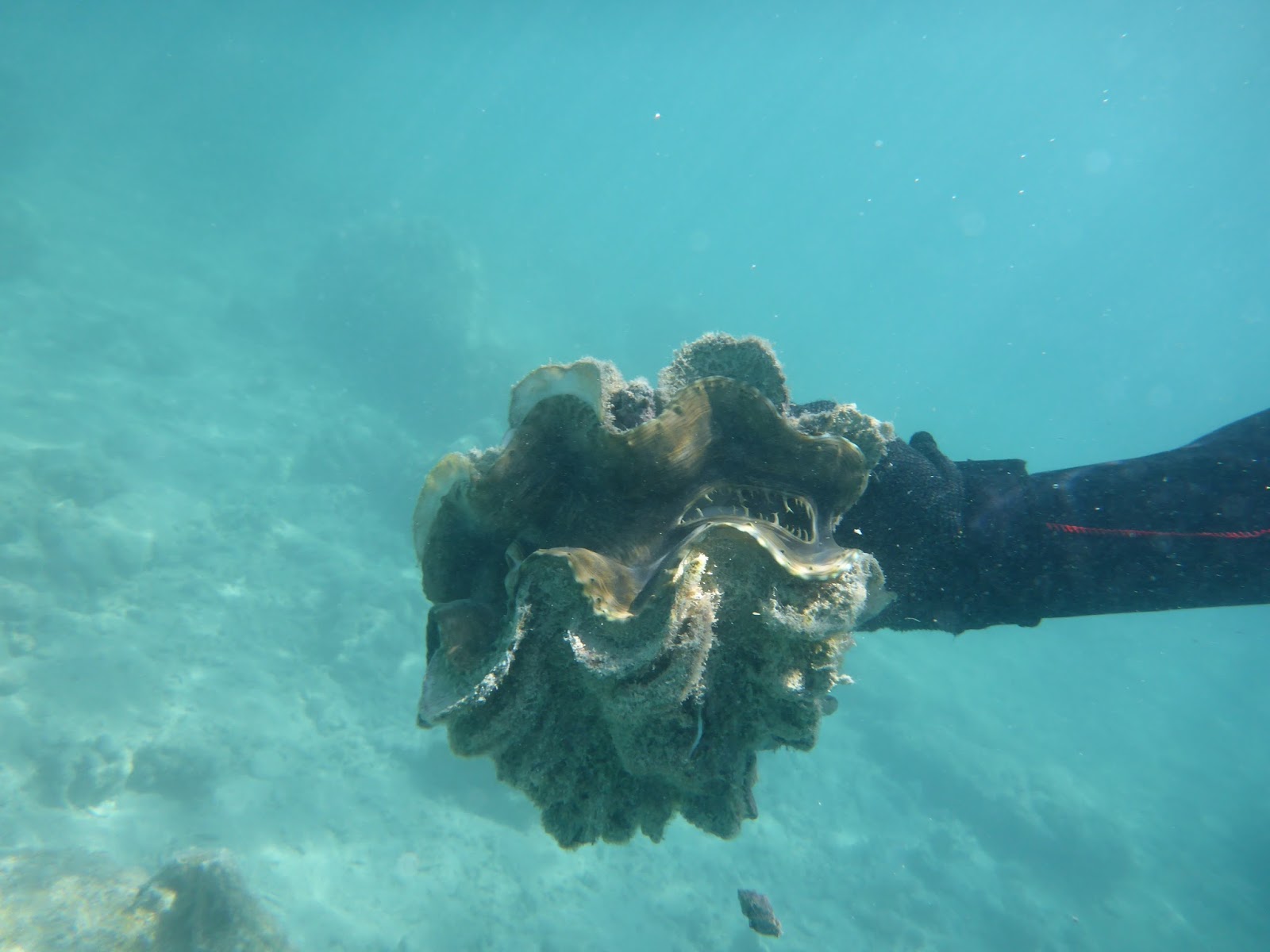
Unlike the smooth giant clams we’d seen before, these have scallopped shells

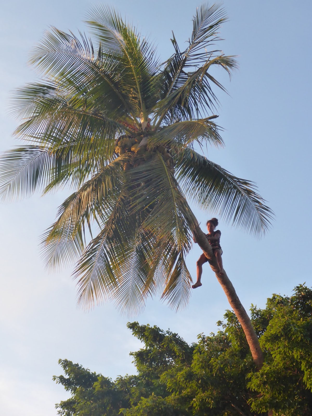
In Waala, the local girls are the ones going up the coconut tree!


We didn’t see anyone on shore, no building, no village.  But the snorkeling wasn’t quite what we were looking for, so we moved north.
Waala Bay, Ile Art (Beleps) – The inner mall-boat harbor.

Waala Bay: red sand and gravel shore

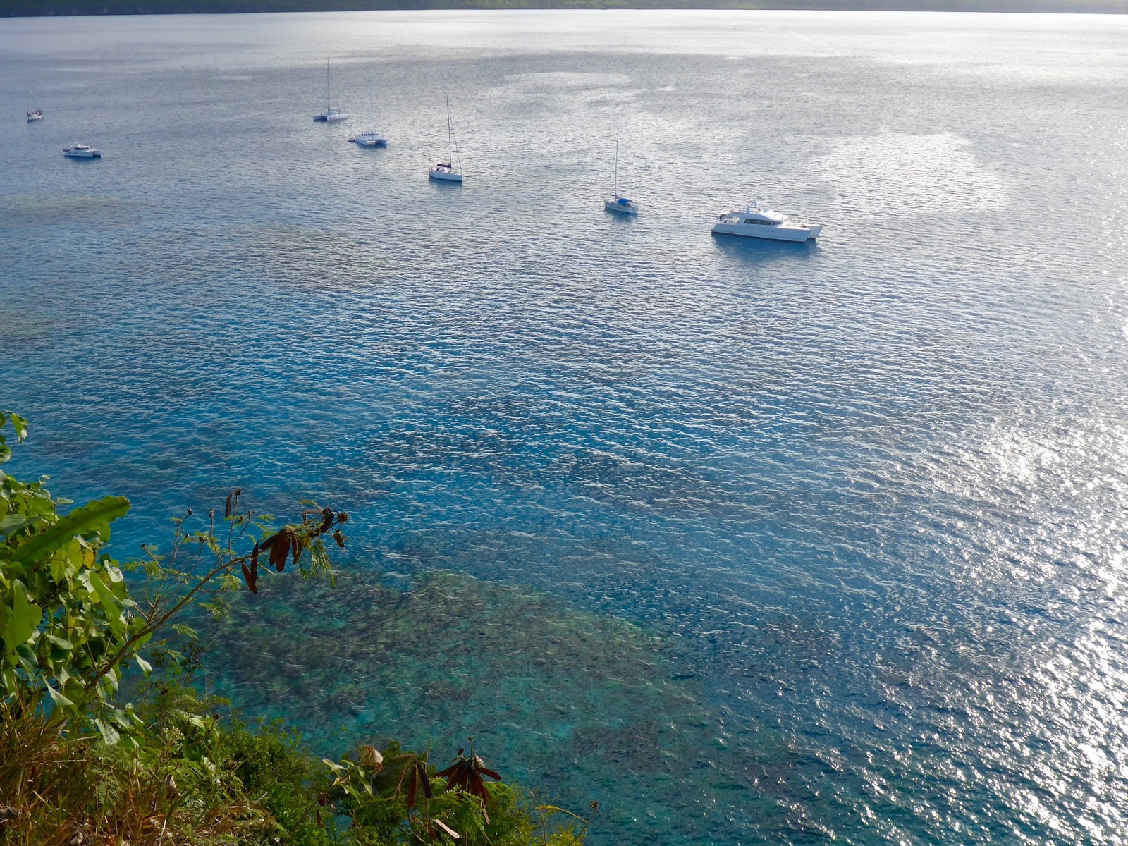
Ile Art (Beleps) Waala Bay anchorage

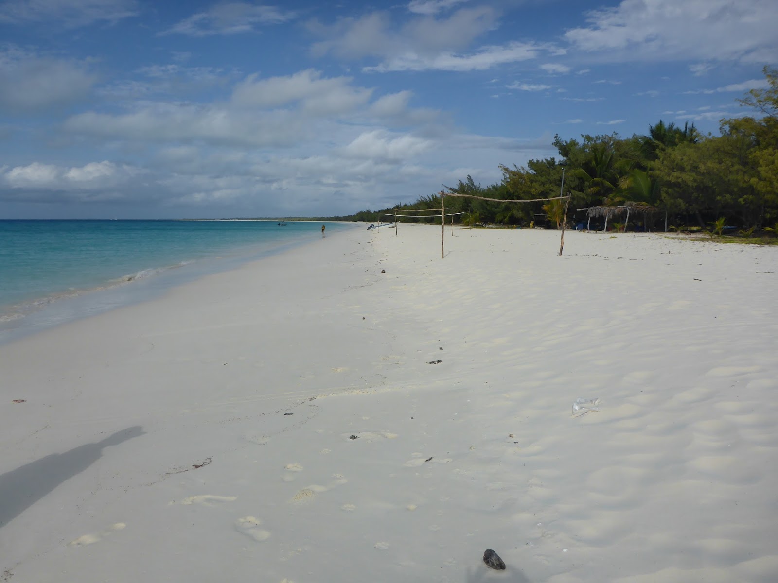
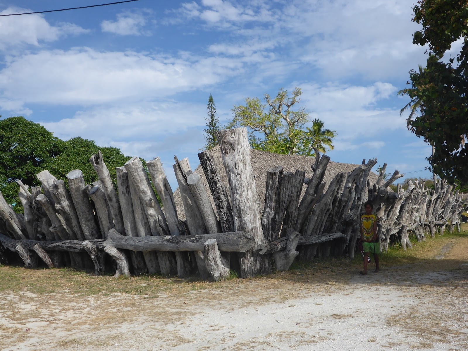
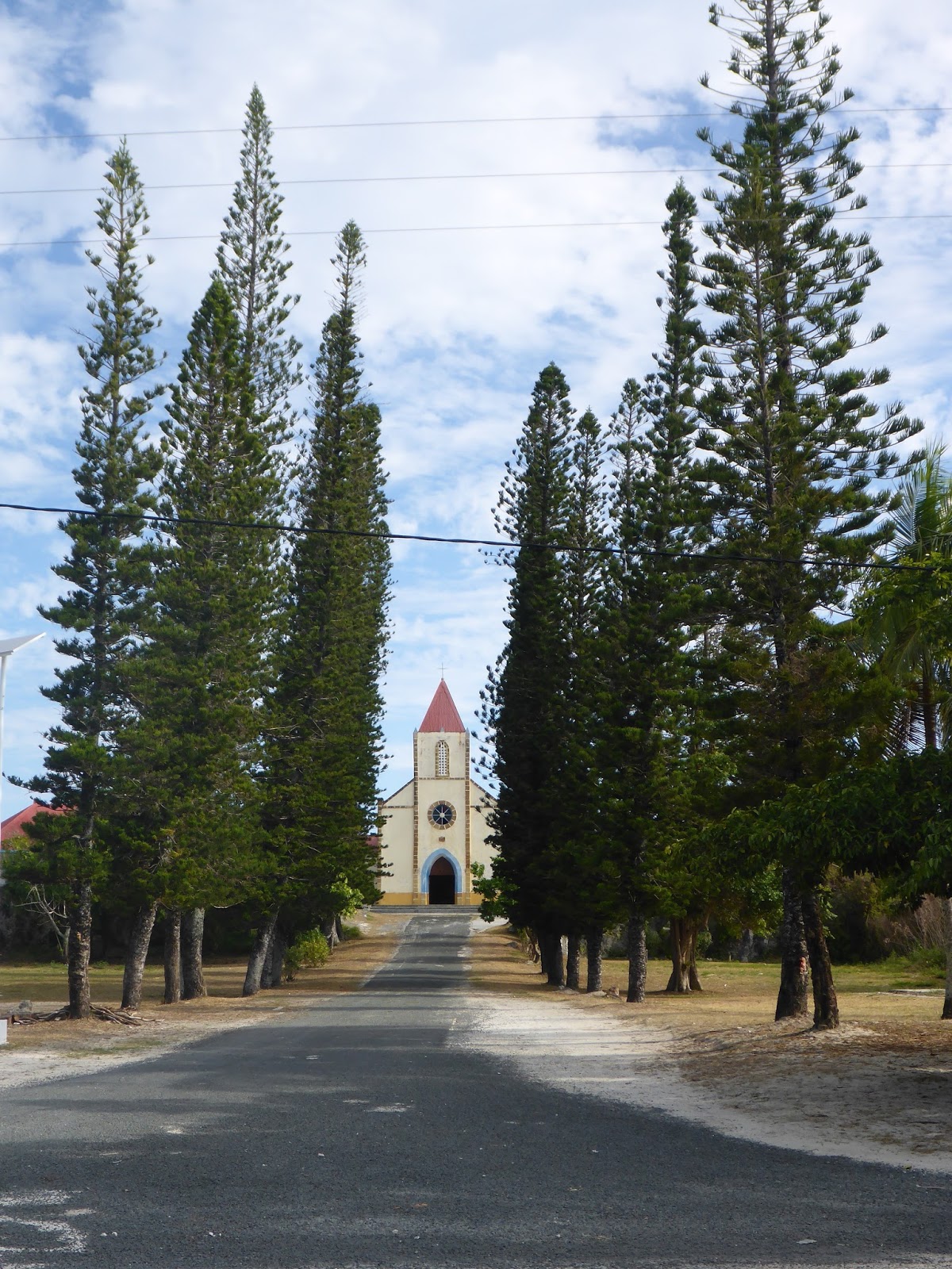
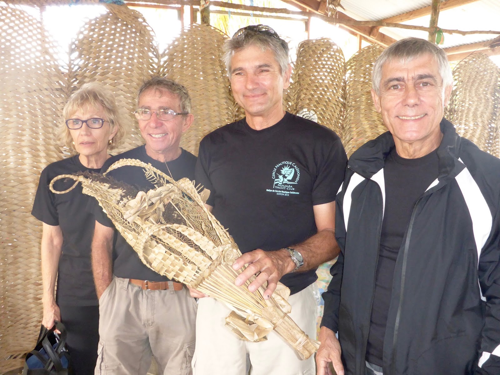
2nd stop: ILE ART (Belep Islands)  – Waala Bay 19*42.841S – 163*38.566E – This is a MUST STOP – In Waala, you must present la “Coutume” to the Grand Chef.  He controls the Great North.  His hut is easy to find: anchor in Waala (see point above) and land your dinghy while aiming towards the mark planted on shore.  

Waala Bay… see the yello mark on shore, left of the pangas?  That’s the Chief’s compound.
Make sure to head towards the church before turning left toward the mooring balls

Make sure to favor the east end in order to avoid the reef (save your dinghy’s prop!)  The Chief is cool.  He took us to the great “Case” and accepted our gifts, chatted for a while… and off we were, OK to visit the entire Great North!

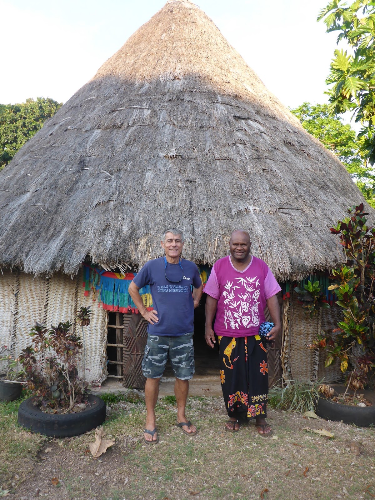
The Chief clears us in!
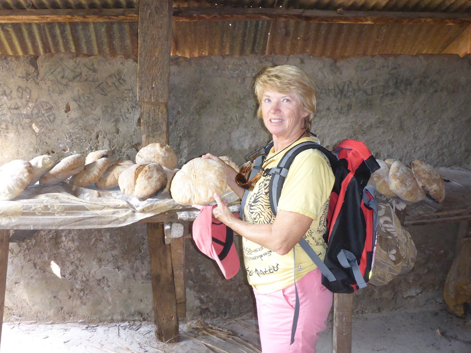
The conch rang: time to go for bread, hand-worked and wood-fire baked!

Waala Bay is not a good spot for snorkeling.  Again, the water is very minerally charged, visibility not so good… however, there is a small boat harbor and a regular ferry service from Koumac (main land.)  It’s a sheltered anchorage and, in a few days we would have to return to seek shelter while another front passes.

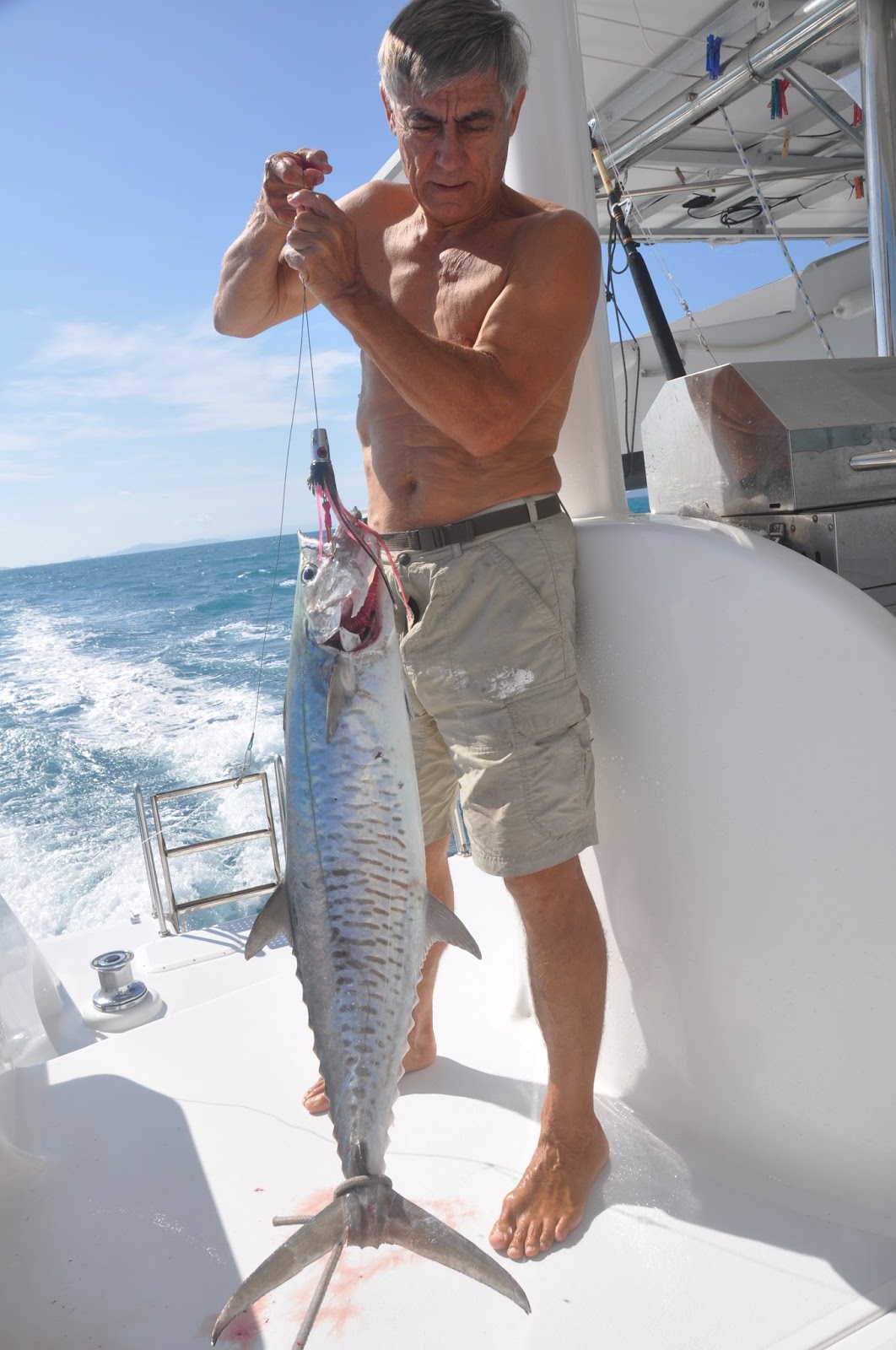
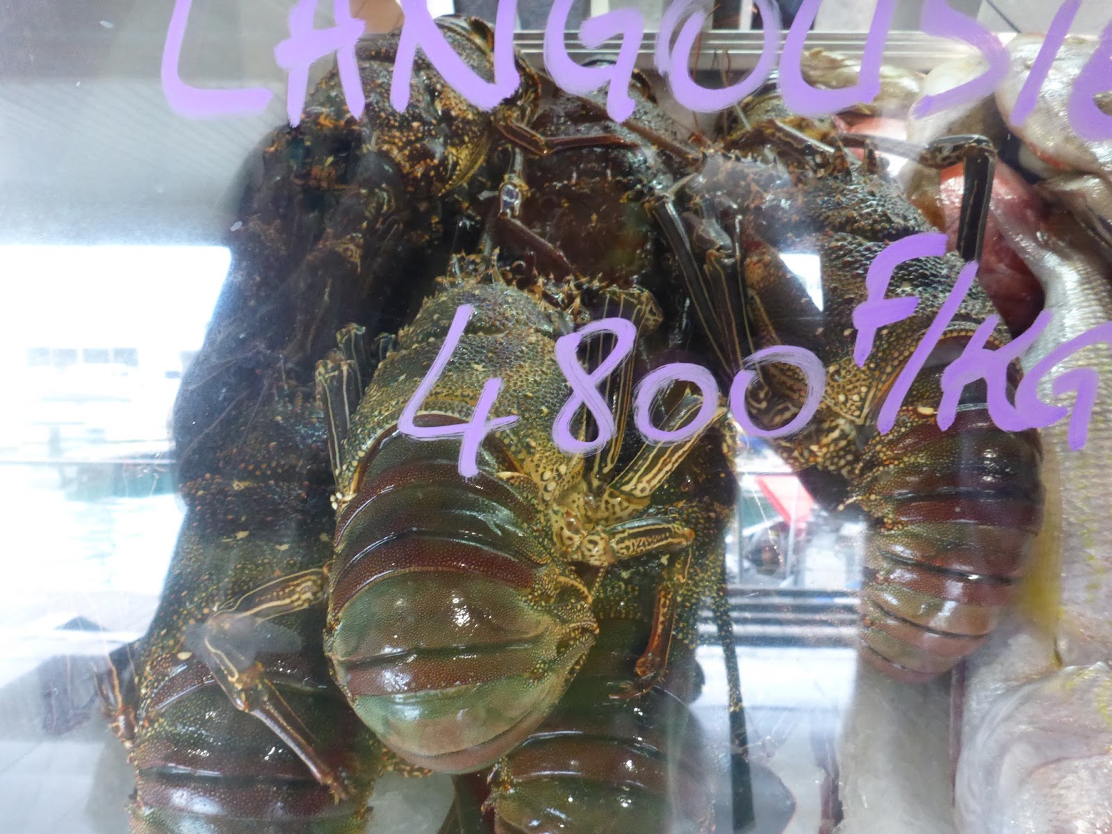
In October, the water is not too warm… and the spiny lobsters plentiful!

The town is quite lively and divided between clans.  Each clan has its own bakery and grocery store.  If you’re waiting for bread, you’ll know that it’s baked when you hear the baker sound the Triton conch!

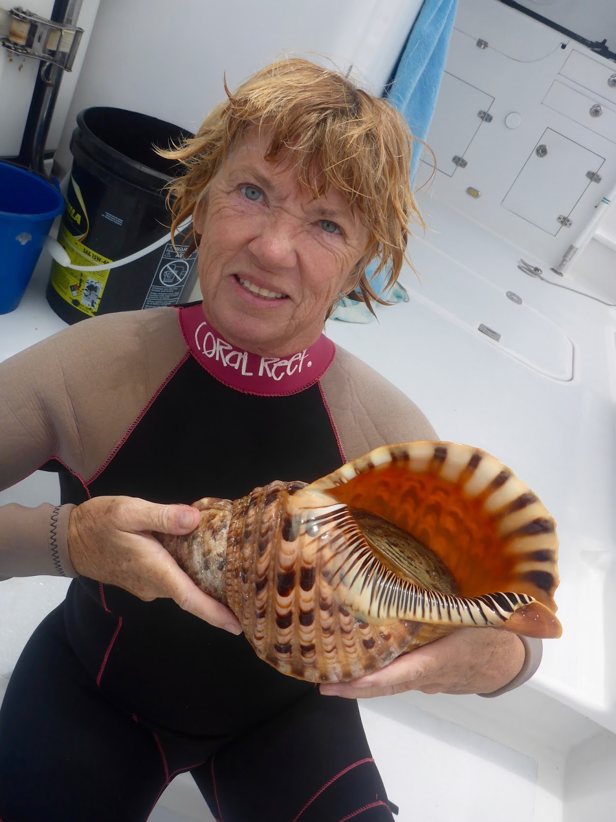
Snorkeling the top of the reef, you can find these giant Tritons.
Take pix and put them back.  Not only are they illegal to take, but they are the only
natural predators to the reef-eating Acanthaster 

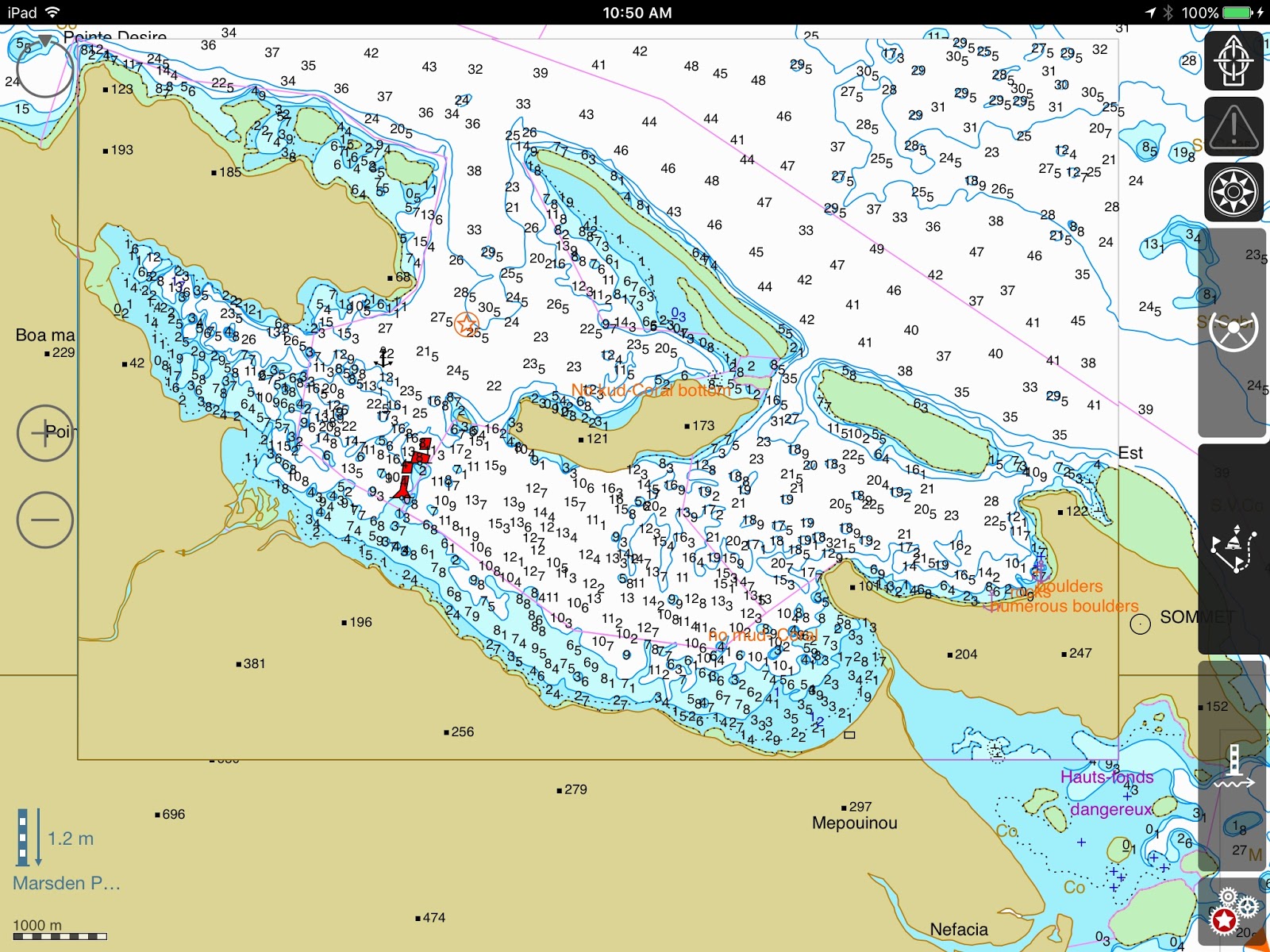
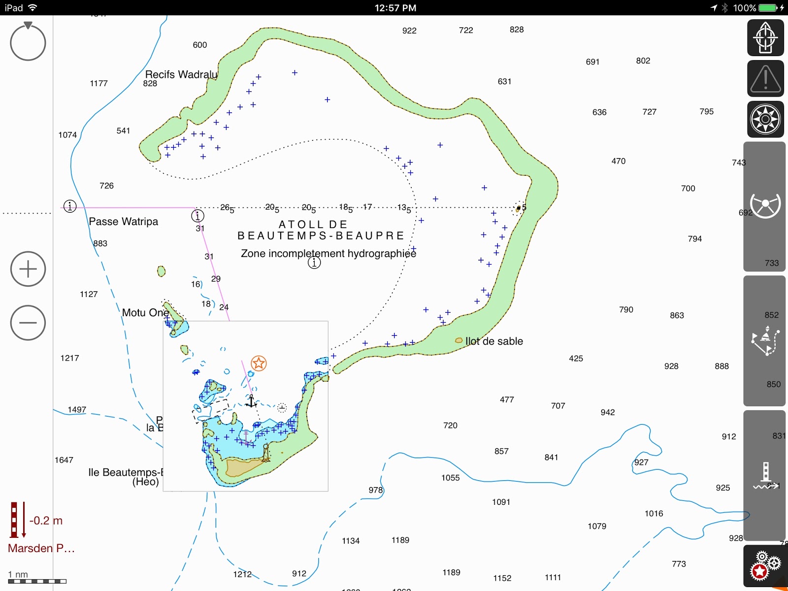
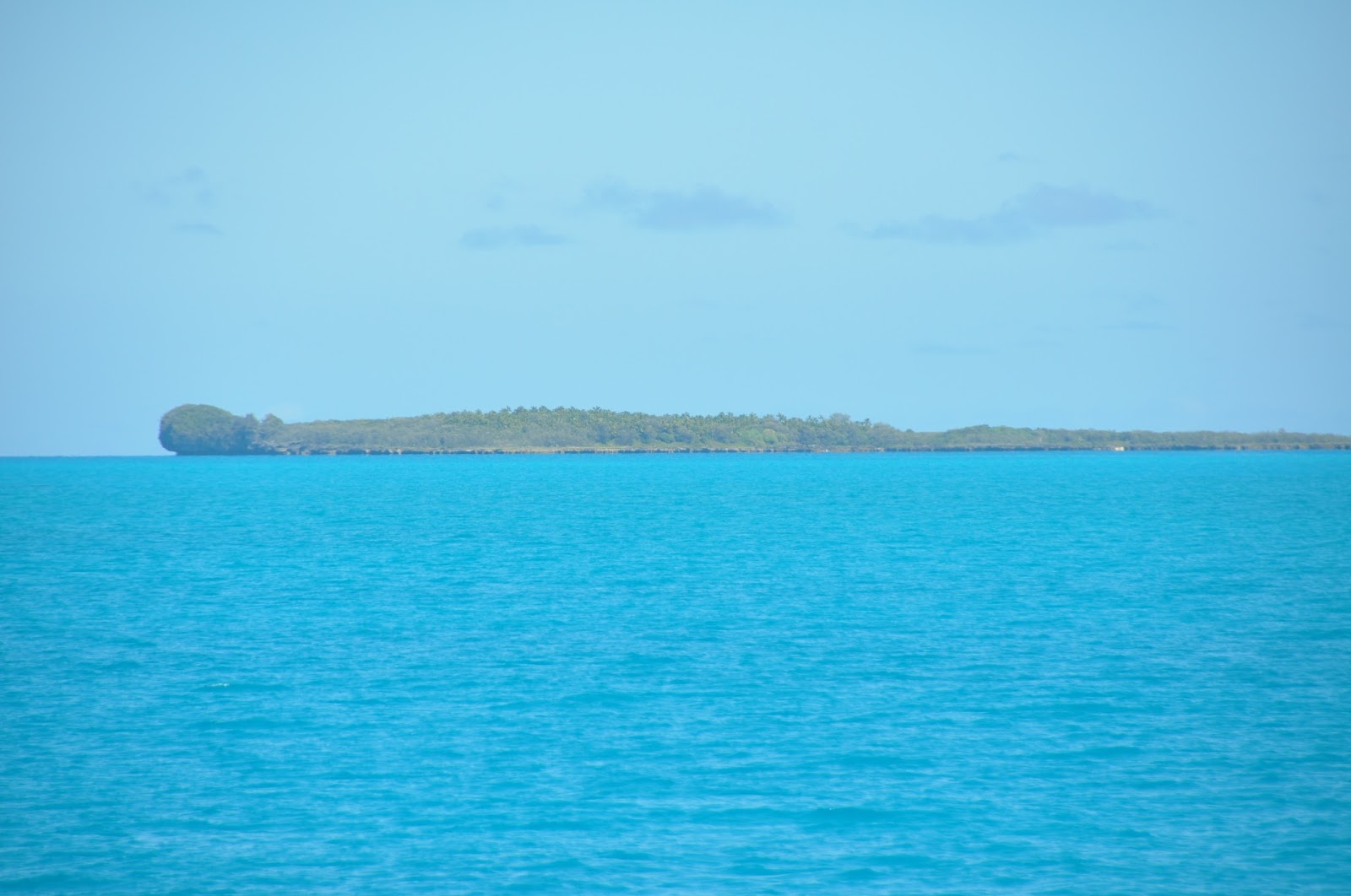
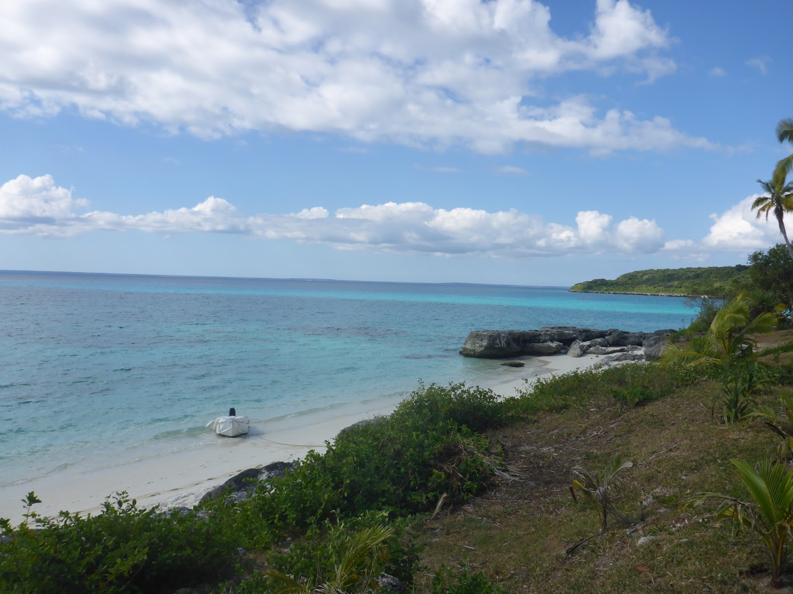
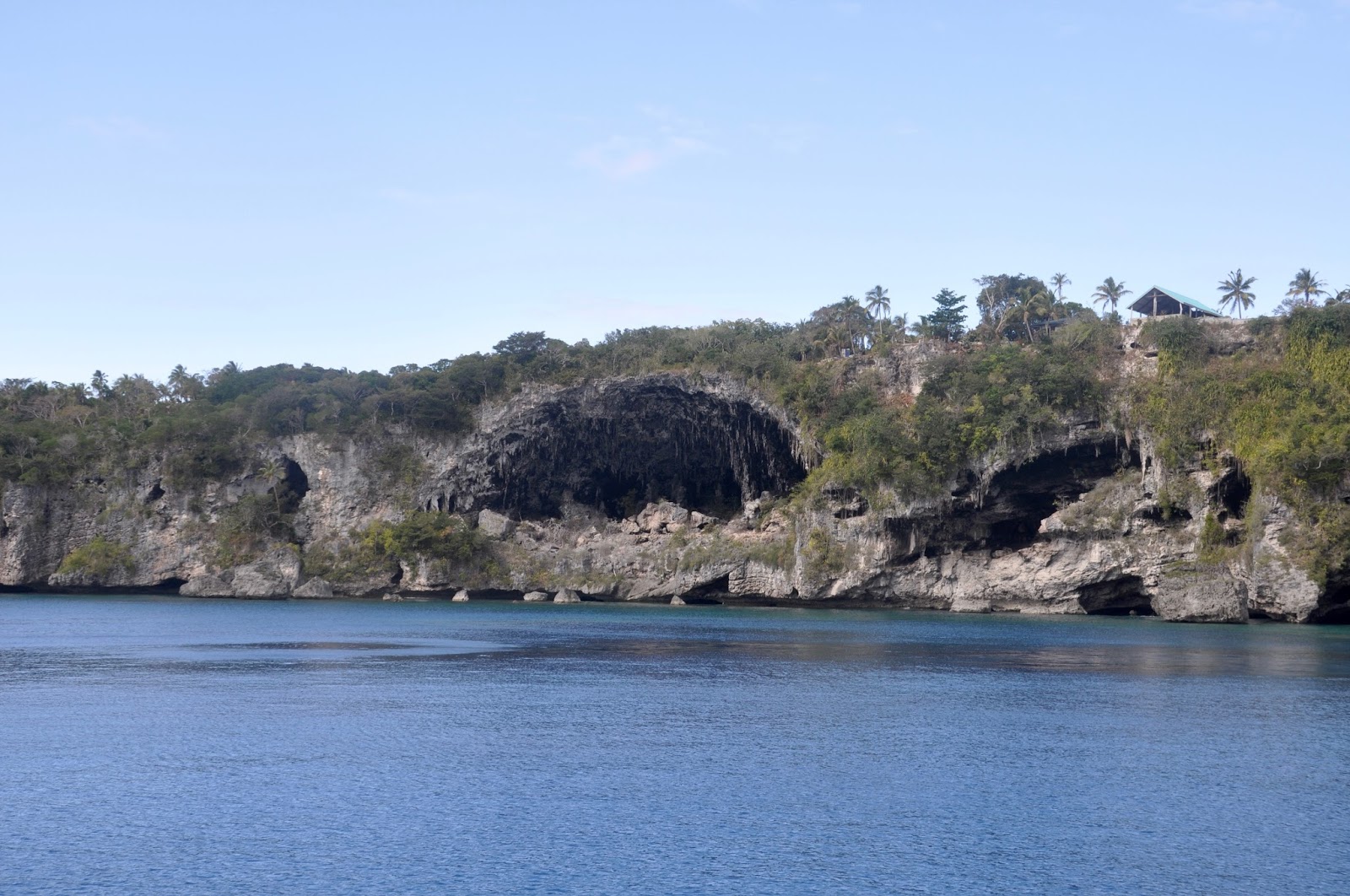
3rd stop: Ile Pott – 19*34.687S – 163*35.132E –  That’s what I’m talking about!!!!  Completely surrounded by reefs, this fantastic anchorage is a slice of Paradise. 

The way into Pott’s anchorage

There is not a lot of room and DOMINO certainly filled a fair slice of the anchorage.  The entrance is narrow, best entered at low tide for best visibility over the reef, and better favor the southern shore: it has fewer underwater surprises!! 

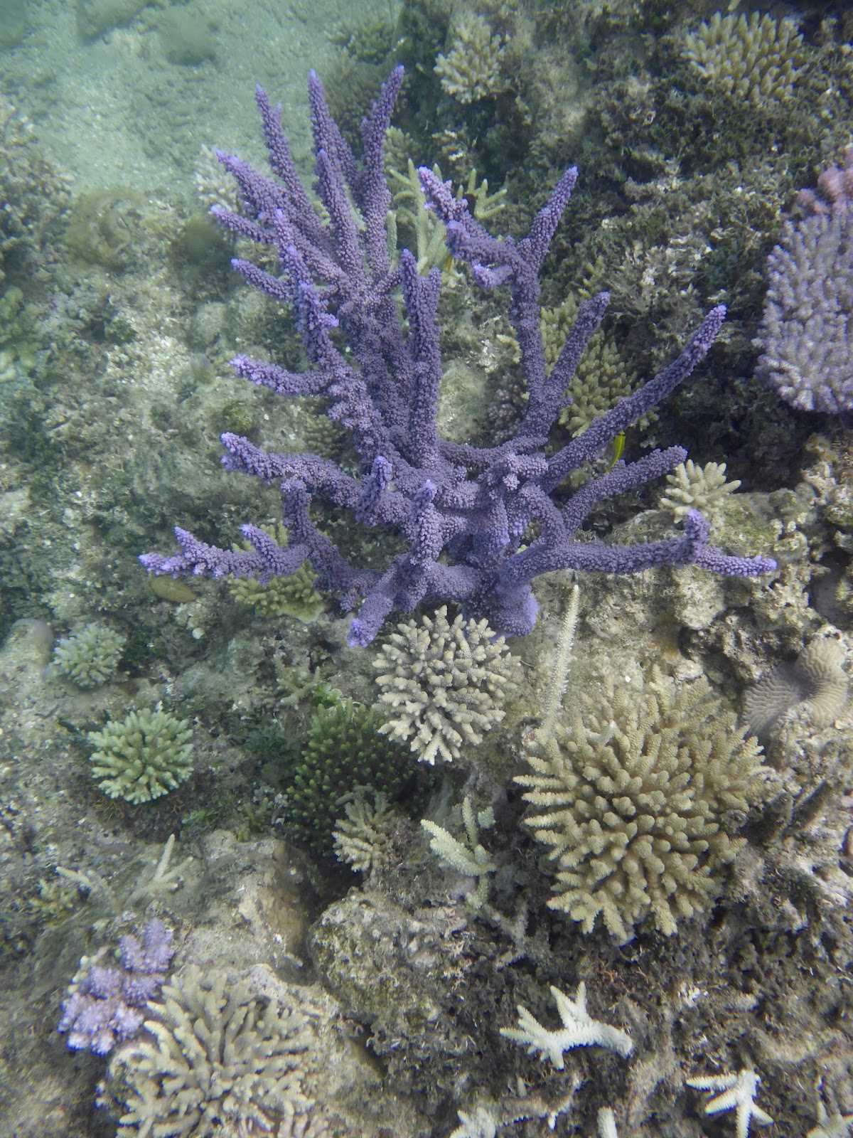
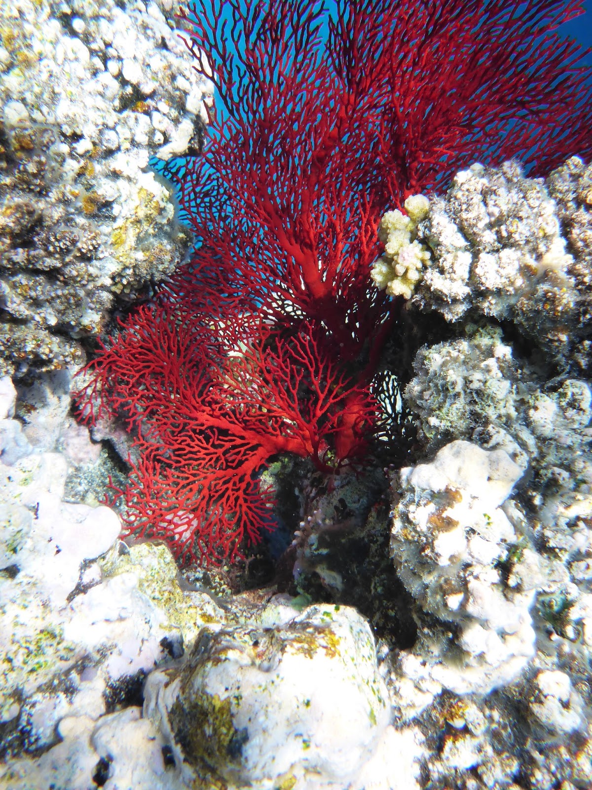
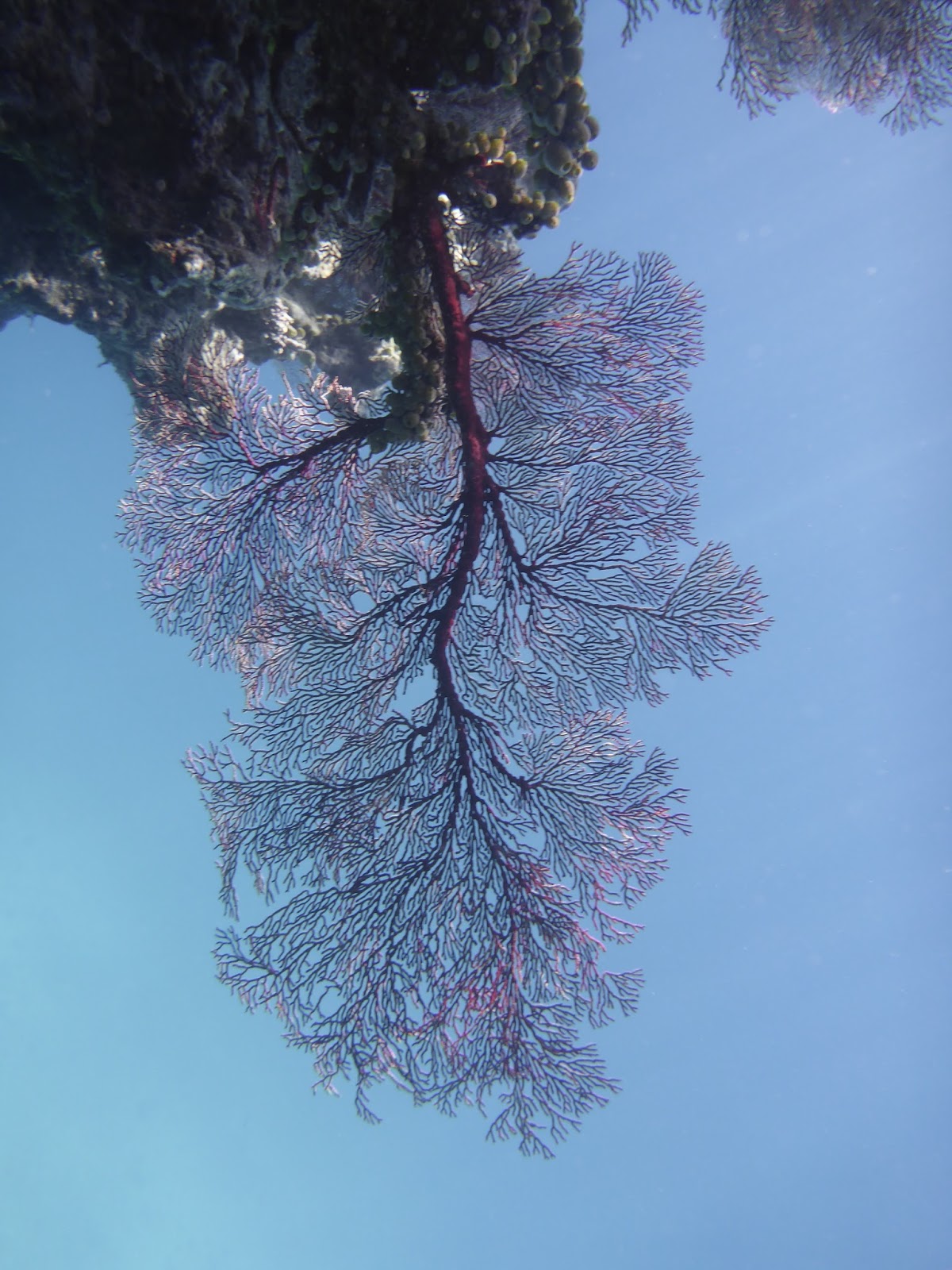
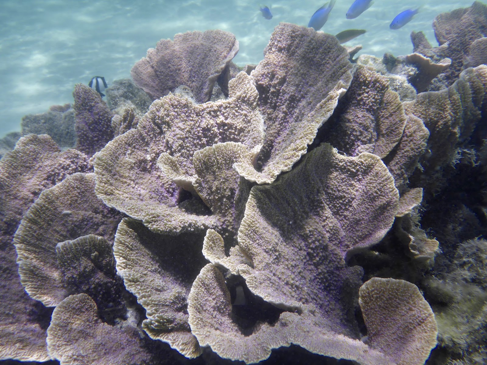
Striking purple coral
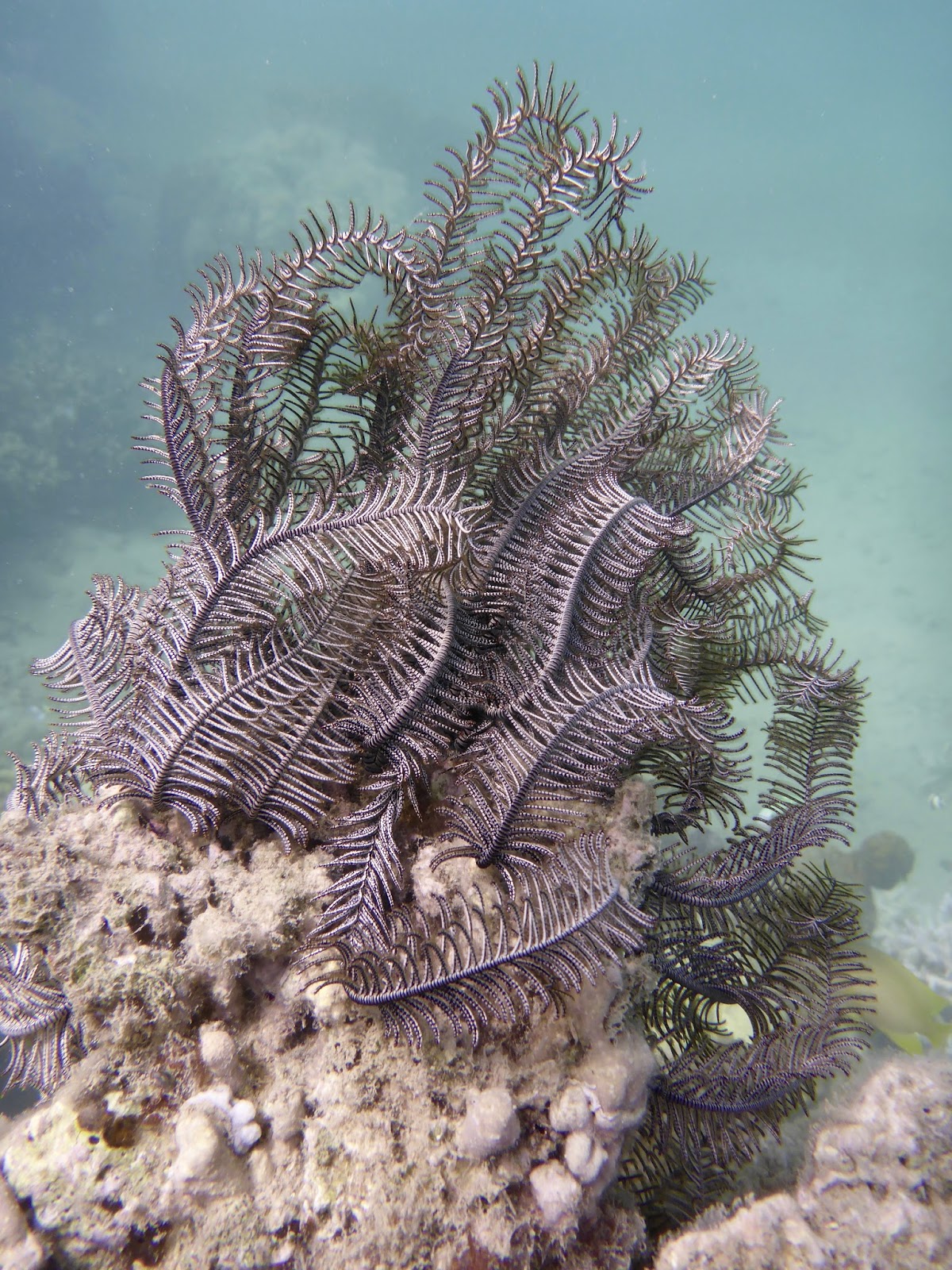
We spent 4 days in Pott and would have spent more if a front and bad weather had not called us back to Waala Bay.  What can I say about this place but that it’s some of the most pristine snorkeling we’ve ever found.  I let you enjoy the pictures.

Add caption

Next?  The West Coast and its reserves and sancturaries… you ain’t seen anything yet!

Till next time…

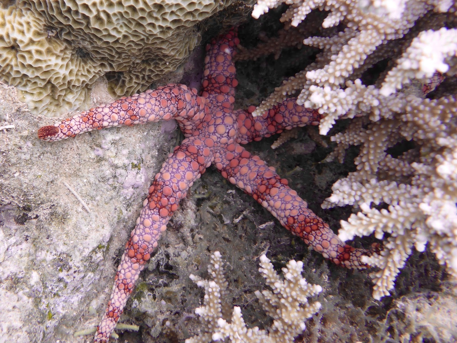
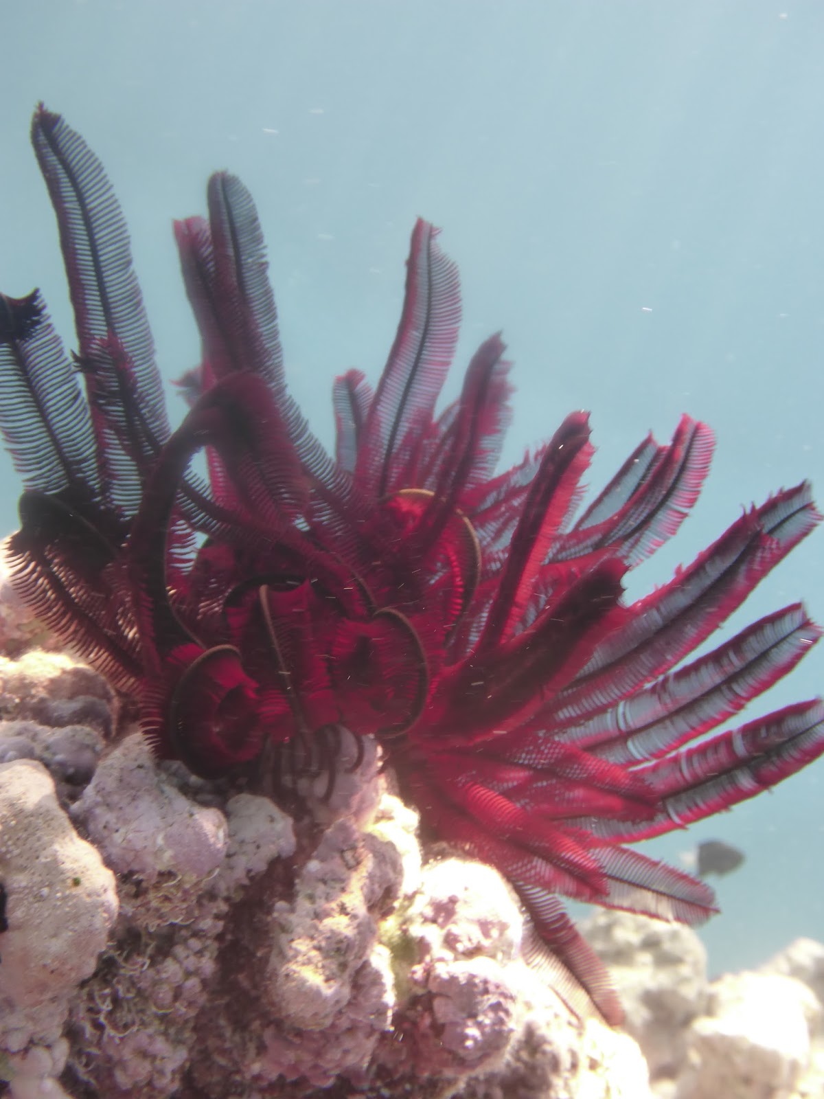
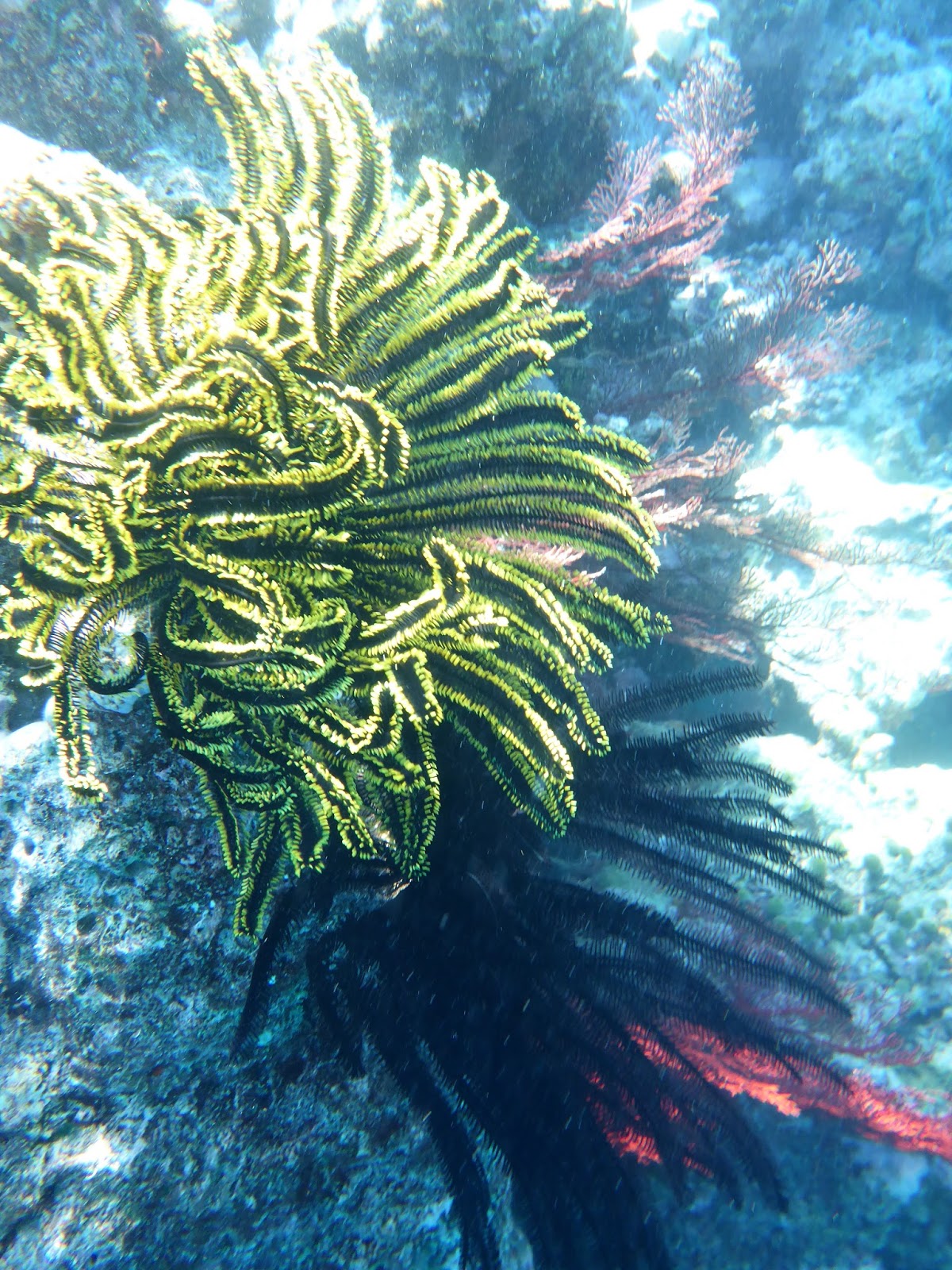
Fern seastar: this starfish sports up to 20 arms and buries its body into coral holes and between rocks
dominomarie

NEW CALEDONIA – East Coast

NEW CALEDONIA – East Coast – In search of good holding.
October 2017


Hienghene – A gem not to be missed

Circumnavigating New Caledonia is typically done in a counter-clockwise fashion.  Since the prevalent trade winds are SE, it’s wiser to cruise northward along the east coast, pushed by the Trades, and travel south along the west coast, sheltered from the Trades.  Well, that’s the usual plan.  As for the Great North, just look for calm days because there is nowhere to run!


Our route:  Kouakoue, Port Bouquet, Lifou, Ouvea,
Beautemps-Beaupre, Hienghene, Baie de Pam


The East coast —referred to as “The Forgotten Coast”— is magnificent: rugged, wooded, with high peaks and rocky shores, dotted with high columnar pines firmly planted in the rich, red soil.  New Cal is a prime exporter of mineral, Nickel being the foremost, but also chromite, copper, gold, iron ore, manganese, and silver.  For once, I found that the trips ashore were as interesting as the underwater discoveries.  


STOPS TO AVOID — Kanak independentists are very active and sometimes violent.  they have been known to throw cow carcasses into the harbor in Canala to prevent access to the town.  From Canala, bands of activists regularly infiltrate and agitate the surrounding areas, particularly around Mont D’or.  During our stay, activists regularly blocked the main road and several times attacked the regular police force and even took aim at the firefighters!  Here are the stops you DON’T want to make:  Canala and Kouaoua


Ouinne and Kouakoue bays


Stop #1 – KOUAKOUE  (We bypassed Ouinne as the SE wind did not favor that anchorage)  For a first glimpse at the Easter Wilderness, this large bay filled us with peace, earthy smells, green slopes and red earth… and a choice of anchoring spots… well… kind of…

– The sandy beach on the eastern side of the bay is private: no anchoring there!

– The southern part of the bay seems to offer great protection from the Trades, but as we tried to set the anchor, we only bit into coral rubble… not good!


Nice snapper, right?  Except that we both got Ciguatera poisoning from it!
Better stay away from lagoon fish.
– The western end of the bay, then! 21*55.804S – 166*38.595E – With the wind staying below 5 Kts, there was little risk of rolling.  BAM! The anchor dropped through 8 meters of rust-color water, sunk into the earthy bottom, and just stuck there.  Lovely anchorage indeed, and not a soul around… no fish either… but a good overnight stop in Pure Nature.


Port Bouquet – Before dropping anchor, scan the bottom!
Stop #2 – PORT BOUQUET   This looked like a great stop and fishing spot, a lagoon entirely surrounded by reef, and no wind at all that day.  That looked like promising snorkeling.  Well, don’t count on snorkeling on the East coast.  The water is heavy with minerals and visibility marginal.  And the anchoring??? 

Marbled grouper on the line… uhm…. not to big, will attempt eating it… Ciguatera warning!

Armed with waypoints and directions, we proceeded to Anse Toupeti, where the depth seemed OK… 10 meters would be perfect, right?  But as JP sounded the bottom with the DFF3 Fish Finder, all he saw was peaks and valleys, bommies, coral heads, boulders and rocks, nowhere to drop the anchor.  

For hours, we toured the lagoon: Anse Lemia, the north coast of Ile Nemou: it was the same bottom relief: coral and rocks.  At least, we trolled around the reef and caught a nice sierra, but still had not found a decent spot to anchor.  It would have been great to anchor in front of St. Roch and visit the village, visit the mines… but we didn’t feel comfortable with dropping the hook in rocks and coral. 


Dog-tooth Tuna: all day long!


Toupeti: 21*41.304S – 166*25.503E -At last, JP wedged DOMINO in a small sandy spot, surrounded by big boulders, and with terrible anxiety I dropped the hook in 3 meters of water, on a short scope, hoping that we would clear the rocks all around us.  If the shore was as lush and inviting as could be, the water was not.  It was a short night, and the morning saw us escape East, to the Loyalty Islands.


Hienghene River… Can you say GREEN?
Stop #3 – Hienghene – 20*41.012S – 164*56.879E – As you know, I’m not a land person and I go to shore as little as possible.  Not for me, the trips, trecks, walks, promenades, views from the top… no sireee… I’m a water baby!  

“Tour Notre Dame”… AKA “La Poule” (The Hen)

But Hienghene got my attention, stole my heart, and I actually went on a 3-hour walk in the hills.
  It’s a MUST !!! 


Drunk with the smell of Niaouli (the local wild eucalyptus) we drunk more: the views on “La Poule,” (the hen-shaped rock that guard the bay), the green lagoon that receives the Chester Cliffs, the green river that snakes all the way into the bay.  

The green inner lagoon inside the Chester Cliffs

We forgot about fishing and snorkeling again (nothing there) and enjoyed the walk, the small town, a nice meal at the “pension” and a very quiet anchorage.


Baie de Pam


Stop #4 – Baie de Pam – 20*14.190S – 164*18.234E – Woops…. the Trades are blowing hard, 20Kts and forecast to reach 30-35!  Time to seek shelter.  At the northern end of the East coast, the very deep Baie de Pam offers excellent holding and shelter.  From Hienhene to Pam, the inner reef channel offers good protection from the swells, and with the wind in our back, the passage was a cinch… and we landed some nice fish:  dog tooth tuna (plentiful in the north!) – 


All I managed to catch was a Giant Estuarine Moray

Well dug-in at the bottom of the 800-meter hill, we waited for the storm.  But we were attacked by a storm of another kind:  FIRE!  What had started as a small brush fire along the road was slowly expanding, and as the wind picked up the entire hill was on fire.  Gusts at 30+ were fanning the flames and pushing the smoke towards us.  It was an ugly 48 hours, filled with wind and smoke and nowhere to run.  That’s the way it goes… 

Smoked-out!
Brush fires are, indeed, a major problem on the islands.  “Controlled” burns too often go out of control, the vegetation is decimated, the land bare, and subsequent rain washes out the soil, creates landslides.  During our last week in NC, a major landslide occurred on the East coast, killing 8 people.  Farmers are active in educating against the slash/burn technique, but it may be too late to save the island.


The wind has died, the fire lingers… and we’re off… to the Great North!

Till next time…

dominomarie

NEW CALEDONIA – LOYALTY ISLANDS – OUVEA

NEW CALEDONIA – LOYALTY ISLANDS – OUVEA

IN SEARCH OF THE RIGHT CHIEF (Happened to be a woman!)

The anchorage at Mouly: sand, sand, and more sand
Weather is uncertain, an alternance of highs and lows, of calm and storm.  After a week of lovely weather in Lifou, Weather caught up with us in Ouvea.  A 2-day storm had us locked into Ouvea’s anchorage

Ouvea, The Pleiades, and Beautemps-Beaupre

But it was a good time to start on our mission: get authorization to cruise the famed Ile Beautemps-Beaupre, north of Ouvea.

Mouly & Fayaoue

 As usual, we had to find the right chief, but things are a bit more complex in Ouvea.  If the island itself consists of a crescent-shaped spit of brush, the north and south-west of the lagoon are fringed with a constellation of small islands called The Pleiades.  Each group is the property of (and controlled by) a specific clan.  Beautemps-Beaupre (BTBP) belongs yet to another clan.  We had 2 decisions to make: which islands did we really want to visit; and how many “Coutumes” did we want to present.

Beautemps-Beaupre

IN SEARCH OF THE RIGHT CHIEF….

Mouly’s beach: talcum powder

Try #1 – MOULY – 20*43.18S – 166*25.30E – I love dropping anchor in 8 meters of water over miles of sand… so much easier that between coral heads, especially when it’s blowing 25 knots!  Off to shore promptly, looking for the chief.  

La Cheferie de Mouly
Controls Mouly and the Western Pleiades
We found the “Cheferie,” harkened by its massive tree trunk palisade, but no chief: absent until the ferry comes… who knows when.  Next!….

Fayaoue –
We only found the small Clan Chief
Try #2 – FAYAOUE – 20*39.117S – 166*31.80E – More lovely sand, anchored in front of the Gendarmerie.  Off to shore again, looking for the Chief.  We met one, who gladly took our presents and declared that we were now welcome to anchor where we were and authorized to walk to town.  Good time to provision at the local store, of course, but when we asked if we could go to Beautemps-Beaupre, we learned that we were only authorized to drop anchor at the Western Pleiades, as this chief was not the Big Chief…  Off to the next chief…

Storm is passed… time to go!
Try #3 – St. Joseph – 20*27.323S – 166*35.323E – Now that the storm has passed, we’d love to hurry up to BTBP, so we race to the Cheferie on the south end of St. Joseph whose palisade we spotted with our binoculars.  Off to shore to present our Coutume.  Yes, we’re welcome to now cruise the Northern Pleiades, but Ile Haute only.  What about BTBP?  Nope! The chief controlling these parts has recently died, but perhaps his widow would give us authorization… 

St. Joseph… pass the church and you’ll find the Cheferie
And off we were, on Try #4, found the Widow at her home behind the grocery store by the church and yes, she was glad to give us her blessing for BTBP: do not go to shore, do not scare the birds, do not light fires, do not throw garbage, do not fish inside the lagoon, do not spearfish inside the lagoon… OK, we promised!

Yes, it’s a tangled web!

At last, by 9:30 on October 18th, we were underway, threading between the glittering necklace of the Northern Pleiades, almost tempted to stop at Ile Haute, and 2 hours later we were anchored at BTBP.

Exiting through the Northern Pleiades – Ile Haute
Some charts indicate an anchorage on the western end of the island, but this was way too shallow an reefy for us.  We preferred to play it safe and anchor north of the small island.


This is a place for snorkeling.  There is no easy access to shore.  Millions of birds rook on this little island and it is best not to bother them.


Underwater, though, it’s a different story.  We had our first peek at red soft coral and the never-ending varieties of Fern Stars.  The water was so clear that I could see JP diving some 20’ below.


So many new varieties of fish and —a highlight of New Cal— a plethora of Butterflyfish and Anemonefish.


As lovely as the anchorage was, the snorkeling was limited and since there was no hunting allowed and the anchorage was quite rolly, we decided to move the next day.

Shen’s Anthias
We could have stayed a few more days, but the roll got on our nerves: there are so many more anchorages to explore!

Where to?  The East Coast of New Cal.

Till next time

dominomarie

NEW CALEDONIA – LOYALTY ISLANDS – LIFOU

NEW CALEDONIA – LOYALTY ISLANDS – LIFOU
DOMINO at anchor in Doueoulou (Lifou, Santal Bay)

As luck would have it —and as it it often the case in the cruising world— we found friends in Noumea.  Annie & Claude (S/V “Moemiti”) —whom we had first met in the San Blas Islands— are based out of Noumea.  Claude had just completed the “Around New Caledonia” race and was itching to go sailing again.  Our lucky day:  the CNC (Cercle Nautique Caledonian) was organizing a rally to the Loyalty Islands and, yes, we were welcome to join them!  What a treat!


S/V “MOEMITI”

Although we diverged slightly from the CNC’s itinerary, we met them in Lifou for a wild few days.

New Caledonia and the Loyalty Islands

The Loyalty Islands consist mainly of 3 islands located some 60 miles off the east coast of New Cal: Ouvea to the North, Lifou in the middle, and Mare to the South.  While many cruisers on the way from Fiji or Vanuatu stop in Mare (indeed, you can do a temporary clearance in Mare’s Gendarmerie,) we bypassed Mare and went straight to Lifou.


Exchanging gifts is a tradition

In the islands, the Kanac culture remains strong and must be respected.  In every anchorage, a visiting yacht must present “La Coutume” to the village chief.  This is a simple gesture (“Le Geste”) of respect from the visitor towards the community, and consists of a simple gift (cigarettes, money, T-shirts, or even foodstuff) wrapped in a “pareo.”  The trick, though, is to find The Chief… there is the tribe chief, the little chief, and the big chief… each is eager to tell you that he is the one in charge, but we found out that each only rules on a specific (and often small) territory.  When in doubt, ask for Le Grand Chef (the Big Chief) whose compound is usually recognizable by the palisade of massive tree trunks that surrounds the “Cheferie.”


Off to Lifou, then, but not without hooking up a Silky Shark, then reeling in a Black Marlin (both released) and hooking up a Mahi Mahi.  


Silky Shark on the line

Black Marlin on the line

Yes, the fish is plentiful around New Caledonia.

Baie de Santal

1st stop: Doueoulou, Baie de Santal –   20*55.336S – 167*04.866E – Named after the sandalwood tree, the large bay is  fringed by lovely white sand beaches.  In the evening, as the locals light their fires, the smell of sandalwood invades the entire bay.


Traditional bure

“Le Petit Chef” accepted our “Coutume,” a gesture we repeated a few days later with the entire CNC fleet, as we were treated to a full island meal of fish and roots.

Meeting the legendary Ron Given.

Our personal highlight?  When a dinghy boarded us at breakfast time and a sprite octogenarian hopped on DOMINO.  “Hi!  I’m Ron Given and I love your Tennant Powercat.  Malcolm was a friend, you know…… (and on and on, as Ron is the chattiest octogenarian I’ve ever met!)  


Our hostesses and cooks in Doueoulou


2nd stop: Dockin Cliffs – 20*42.348S – 167*09.697E –
Dockin’s Cliffs

One of the prettiest anchorages we’ve seen, though dropping anchor between reef patches is always a bit nerve-wracking. 


The anchorage and reef at Dockin


While JP, Claude and Annie were up to scaling the cliffs to have a better view from the top, I preferred snorkeling the splendid sheet coral formations.


The high cliffs are THE attraction here, as well the large cave carved into the cliff… still, I preferred snorkeling with the Anemone fish!


Dockin’s Cave
3rd stop: Plage de Peng — 20*54.329S – 167*07.183E –

This little beach is a MUST: talcum-powder-white sand, fire pit, all for a BBQ and picnic.  


Plage de Peng


Of course, you have to find the local chief to present your “Coutume.”  A Canadian yacht anchored next to us neglected this little gesture and was unceremoniously booted out of the anchorage!


Ron’s catamaran looked like a winner!

It was time for a picnic, singing native songs, and competing in a model sailboat design and race, with sailboats built out of beach combing material.  Intimidating and tough competition, as Ron Given had drafted a full catamaran model and some engineers had come up with pendulous keels.  


Pendulous keel: creative!


The winner?  An 8-year old little girl who used a simple coconut husk for vessel!

The winner


Our entry


Missed stop:  We missed stopping at the Baie of Chepehene, (20*47.515S-167*08.857E) already occupied by a cruiseship.  Yet, it is a popular stop where the Notre Dame de Lourdes Chapel sits at Easo Point.  Also, the easternmost of the 2 red marks in the bay is noted to be a splendid snorkeling spot, replete with sponges of all colors.


After 5 days in Lifou, it was time to take our leave of the CNC fleet and move north.  Next?  Ouvea.

Sunset in Lifou with the beautiful MOEMITI
Till next time

dominomarie

Cruising New Caledonia

CRUISING NEW CALEDONIA
DOMINO and the CNC Fleet in Lifou


January 11, 2017 –  Whangarei, NZ

It’s been months since I’ve posted any report on this blog.  Last you heard from me, we were through with cruising, were going to become landlubber again, spend time with the grandchildren, and—of course— sell DOMINO.  
 Six months have past and DOMINO is still looking for a new owner.  Meanwhile, what can we do?  Not abandon her in a marina, that would be too sad.  The only thing we can do is keep on cruising, taking more time off the boat to satisfy our family needs, and… eventually… bring the boat back to the North American continent.  

As a first installment on that new plan, we spent the last few months cruising New Caledonia, then back to New Zealand for a haul-out and some small improvements (I keep some surprises under my vest!)
The New Cal coast is dotted with Columnar Pines

NEW CALEDONIA  —  Well, I didn’t expect much, really.  I had heard of muddy waters, rivers, nothing very positive.  But what a surprise!  NEW CAL is one of the best cruising and fishing grounds we’ve experienced, pristine lagoons and an extensive and stunningly varied reef system.  Yes, we did circumnavigate the “Caillou” , discovered The Loyalty Islands, and had a great time at it.

(Fixing lunch during crossing, JP asleep, no problem!)

NOUMEA — We left Fiji in late September, not willing to arrive too early in New Cal: October is spring time, when the air gets warmer and the water starts feeling good.  What a lovely ride we had, winds staying below 5 Kts, absolutely glassy seas until we arrived within 20 NM of the ‘Caillou.”  (70 hours for 700 NM, nice and easy!)  


Noumea:  No easy anchorage, packed marina,
full mooring fields.

We arrived Noumea with 15kts @WSW, smack dab amid hundreds of boats of all sizes!  “Whoa! Those Caledonians really love their boats,” we thought, while hundreds of people lined the shore to watch a dozen yachts duking it out.  Suddenly, the Committee boat was on us, pushing us out of the way.  For sure!  I turned around, and there was GROUPAMA barreling down on us!  “OH!  This is the “Round New Cal” race,” we realized, a race in which our friend Claude on “MOEMITI” was participating.  Yup!  Clumsy as we are, we had stumbled on the start of the biggest yacht race in the country.  What a sight (and DEFINITELY NOT the time to snap pictures)!  To appease the irate on-lookers, I innocently raised our “Q” flag and admitted to be a very “ignoRrrrant damn-ed AmeRrrrican.”


NOUMEA ANCHORAGE AND ENTRY PROCESS – The main problems for visiting yachts are the lack of berth at Port Moselle (the main marina), the non-existence of a “Q” dock, the difficulty to find any anchorage available.  


If you don’t want to pay for the dinghy dock at Port Moselle Marina, you can dock in town, in front of the market
and watch the fishermen unload their catch

The two “anchorage” areas outside of Port Moselle have been invaded by mooring balls, all private, placed haphazardly, and nobody seems to know whom to contact in order to grab a mooring.  The Harbormaster continually watches the anchorage and —apologetically— asks any boat encroaching into the channel to re-anchor.  


Spiny lobster: $24/lb

Baie de l’Orphelinat offers a bit more room and less scrutiny from the harbormaster, yet, at the height of the season, it’s a struggle to find any room.

Baie des Citrons is a large bay, and there is plenty of room.  But it is rolly and is very noisy as the shore is lined with bars and night clubs and the locals anchor in that bay to party.  In a pinch, though, it’s a life-saver.

Another lovely sunset!

The entry process is straightforward, though not as easy as in other French islands, as immigration and customs have not initiated an electronic process for all formalities.  The Port Moselle Marina office staff is very helpful in directing cruisers: immigration, customs, phyto-sanitaire: if you start about 8 AM, you can be all cleared in by lunch time.  Don’t try to start in the afternoon: the administrations close down at various times on different days: 1100, 1230, 1500… who knows?  

Upon exiting the country, repeat the process (minus phyto-sanitaire) but don’t forget to visit the harbormaster office for final clearance… and a gorgeous view on the entire port of Noumea!

On shore, Le Bout du Monde is a must: coffee, lunch or dinner, this is THE rendez-vous for cruisers… and whom did we find there, but none other than our “Consuegro,” (our co-in-law), Michel, who is a world-traveler in his own right.  His son and JP’s daughter must think that their dads are of another breed, the “Pied Leve” kind.

We caught up on a few movies (“L’ODYSSEE,” Cousteau’s story: we liked), shopped for French stuff (Croissants, cheese), splurged at the produce market (oh, those olives!) and were itching to go to sea again.  Three days on shore were enough for us!

Where to now?  The Loyalty Islands!

New Caledonia + Fiji Cowries

Until next time…

dominomarie

Passagemaker For Sale

DOMINO FOR SALEREDUCED PRICEFiji – September 2016We’re off to New Caledonia… still DOMINO is for sale and we’ve reduced the asking price!Check her out on the Multihull Solutions website:http://www.multihullsolutions.com.au/boats/pre-owned/power-catam…

TENNANT POWERCAT FOR SALE

DOMINO listed with MULTIHULL SOLUTIONSMalcolm Tennant 20-meter power catamaran DOMINO for saleSelecting a broker to bring your yacht to market is a serious affair.  For weeks, we researched yacht brokerages all over the world and finally settled f…

MULTIHULL SOLUTIONS

MULTIHULL SOLUTIONS
DOMINO in her home port of Pago Pago, American Samoa

Fiji, July 26, 2016.

It’s official… DOMINO is now available through MULTIHULL SOLUTIONS

Ant Kovacevic
BEng (Hons) Naval Architect
Local and International Sales Consultant
Leisure and Commercial
P: 07 5452 5164
F: 07 5444 3792
M: 0499 877 298
DOMINO (and powercat IETA) at the Great Barrier Island, New Zealand

Email: ant@multihullsolutions.com.au

PO Box 15, 33-45 Parkyn Parade
Mooloolaba, QLD, Australia 4557

DOMINO at her last haulout, Norsand Boat Yard, Whangarei, New Zealand, January 2016

We welcome Ant to the DOMINO family!
Where will DOMINO go next?  
Cruising the west coast of New Zealand at 20 knots!

Till next blog…

dominomarie