Archive | Domino RSS feed for this section

BROADSWORD – The Ultimate Passagemaker

BROADSWORD – The Ultimate Passagemaker

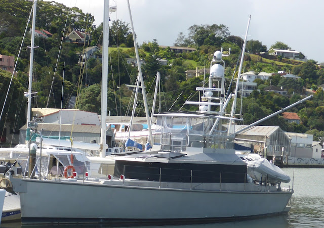
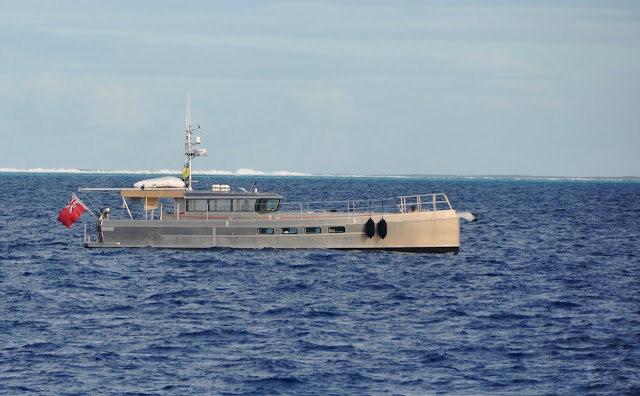
BROADSWORD entering South Minerva Reef
May 21, 2016
North Minerva Reef
PASSAGEMAKERS!  Much has been written about them since Robert Beebe’s initial coining of the term Passagemaker.  As a reminder, what was that initial definition?  A vessel that is affordable, economical, capable to cross any ocean, and simple enough to be handled by a couple with no particular sea-going experience.
BROADSWORD made a “splash” at the Auckland Boat Show
Since Beebe’s Passagemaker and Leishman’s Nordhavn 46, the market has evolved and designers have struggled to fulfill the demand of MORE (accommodations and systems) on LESS (hull length,) often resulting in vessels that are complicated, inefficient to run, and expensive to maintain.  
We spotted Dashew’s ICEBERG off of New Zealan
 Dashew’s sleek FPB series, though spectacular, is yet one step beyond the concept of affordable or simple.  Somewhere along the line, the initial Passagemaker concept has been lost.  Today’s yachtsman should not have to break into Fort Knox to afford  his cruising ambitions and should not need an engineering degree to operate his yacht.  Where to turn to, then? 
Dashew’s complex FPB has, in our opinion, a major flaw: no aft deck room 
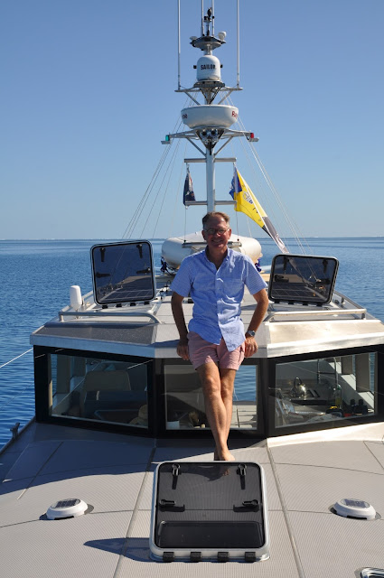
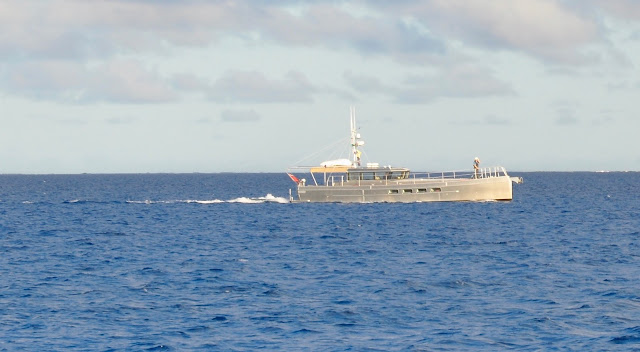
Thanks to Dennis Harjamaa, the Passagemaker concept has just been revived in the body of the  LRC 58.  When we saw BROADSWORD glide into South Minerva Reef without making a wake, its slender aluminum hull gleaming salmon-pink in the rising sun, JP and I fell in love with that yacht.  In addition to its sleek ratio (17.6m/3.6m,) wrap-around windows, spacious aft deck, and one-level living, the LRC 58 checks off every box in our Passagemaker checklist.
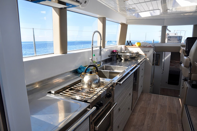
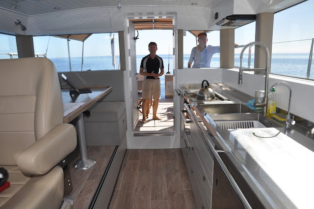
BROADSWORD’s bright galley
  • Affordable: around $700,000 US.
  • Economical: at cruising speed of 9.5 kts, burns 1 liter per nautical mile.
  • Capable: with a range of 4,400 NM at 9.5 kts, this is a true circumnavigator, self-righting should it broach.
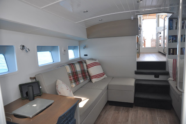
  • Simple: One owner’s stateroom, one head, and adjustable sofas in the parlour that allow for a double and a single bunk.
  • Understated elegance: bare 5083 aluminum, soothing interior in slate-and-sand tones, a classic yacht feeling thanks to the withe-painted wood headliner, sleek integrated stainless steel counters in the galley; this is a true gentleman’s yacht that has everything to please a lady.
The lovely Parlour
Kindly, BROADSWORD’s owner Dominic Park invited us to tour his home, accompanied by the designer himself, Dennis Harjamaa, and shared his story with us.  Dominic was looking for a motor yacht that could fulfill his dreams of spending the summers in Greece and the winters in the Caribbean, meaning two transatlantic crossings a year and the ability to handle the Gulf Stream at any time.  Simple systems and easy maintenance were at the top of Mr. Park’s list.  But no ocean-crossing monohull on the market met his criteria.  Enter the young designer, Dennis Harjamaa. 
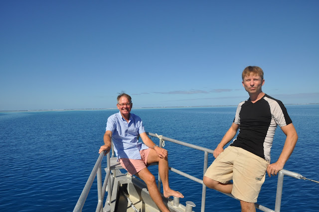
Dominic (left) and Dennis (right) built a lovely, capable, affordable passagemaker
The right man, with the right idea, at the right time and in the right place, Dennis is not your ordinary designer.  Born and educated in Finland, his youth was steeped in the rich brew of sturdy Norse boats.  Dennis then honed his skills at the Washington County Technical School in Eastport, Maine, where he studied all aspects of classical wooden boat building and lofting. After that he spent one year at the Landing School in Kennebunkport.  He is now running Artnautica Yacht Design in Auckland, New Zealand.  Four years ago, he started designing the LRC58 for himself, perhaps to prove the point that “LESS IS MORE.”  With hull # 1, KOTI  (“Home” in Finnish) on the launching block, Harjamaa had triggered enough of Mr. Park’s interest to start building hull #2, BROADSWORD (launched last September 2015.)  Hull #3 is currently under construction at Dickey Boats.  Another hull will be starting construction in Holland within a few weeks.
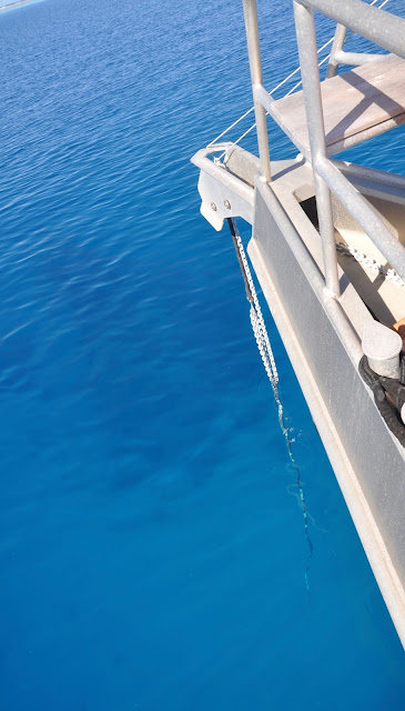
The bow
If we like the LRC 58’s clean design and simple systems, we also like the fact that BROADSWORD was built in New Zealand by DICKEY Boats.  Quality craftsmanship is obvious in all details, great care has been taken at all steps to prevent galvanic corrosion, materials and furnishings are of the highest quality, all complying to the exacting New Zealand standards.  One detail we like: the massive hoisting rings that allow the LRC to be lifted by any crane! 
The massive hoisting ring
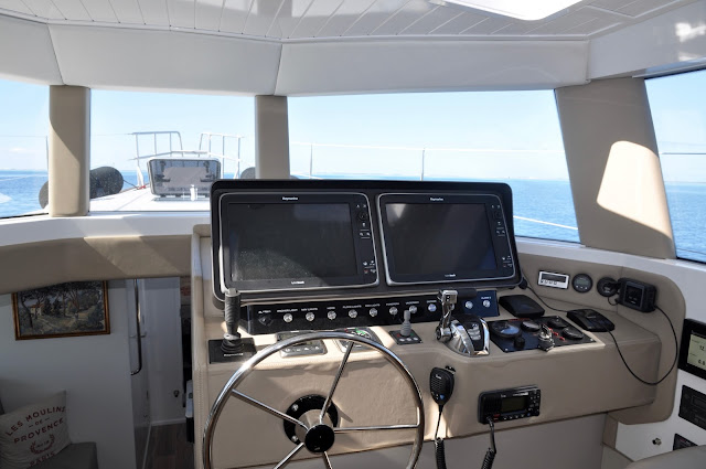
We asked Dominic Park what he liked best about his yacht.  “The bed!”  Indeed, the queen-size bed is spacious, an extension of the parlour where Mr. Park finds serenity while he lounges in the saloon’s diffuse light, appreciating the comfort of a cocoon without the darkness of a dungeon.  He also likes the Raymarine electronics smart suite on C-Zone which affords him to select the running mode of the electronics at the push of a button.
“Mr. Todd” –
We also asked him what he would do differently.  A bigger engine? no, but a get-home engine would be nice, although the LRC58 is fitted with trick-booms that can be rigged with sails. 
The Raymarine Suite
As for Dennis, he particularly likes the KUBOTA engine block, a 4-cylinder tractor diesel engine marinized by BETA Marine in the UK, that comes with a 3-year self-service warranty. Do your own maintenance!
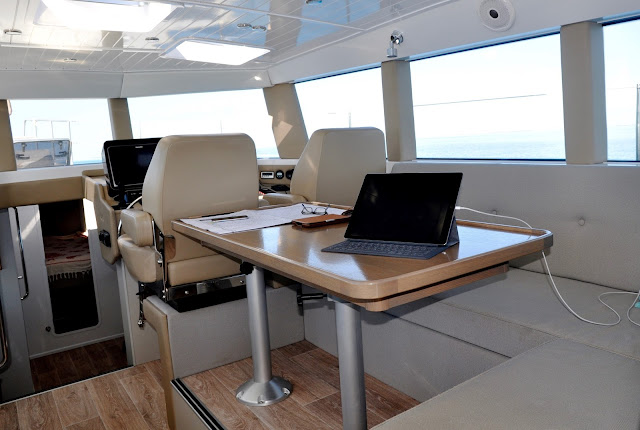
The saloon and helm
What about future boats?  Dennis Harjamaa, still inspired by classic designs ranging from George Buehler’s “Troller Yacht” concept to Nigel Irens and Michael Kasten, even Philip Stark’s futuristic designs, has several designs on the drawing board, including a 20.8m and a 24m cruiser that will have 2 cabins, 2 heads, 2 engines (1 main and 1 get-home.)  Currently designed for Mr. Park —whose requirements now include a crew member— we expect to see this yacht in production very soon.

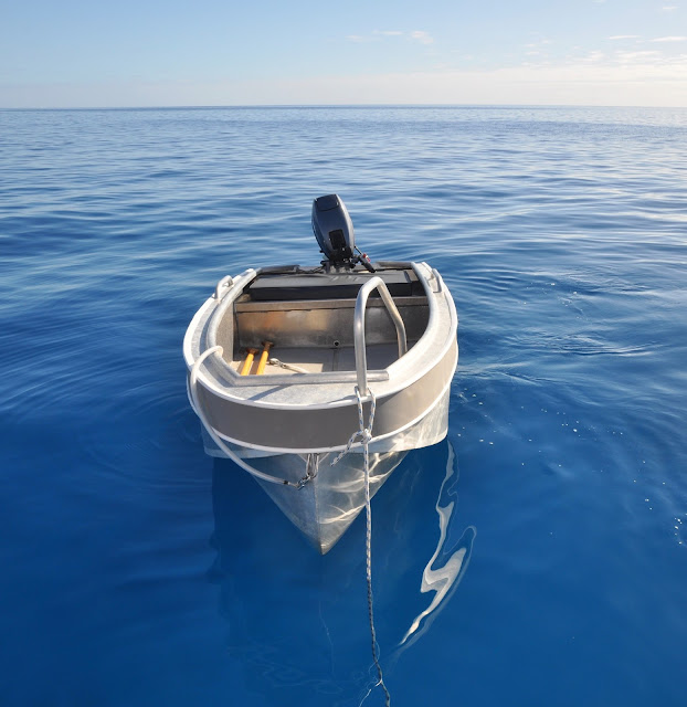
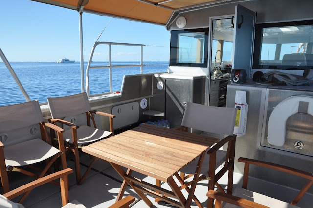
The ample aft deck, ready for dinghy storage during passages: just fold the table and chairs!
Marvelous one-level design, room for a large party!
What about technology?  With an eye on the future but not willing to be a Guinea pig, the designer looks for developments in solar panel efficiency, gyroscopic stabilization (LRC58 has no stabilization and perhaps needs none) diesel electric engines, proven and tested.  Dennis will not put a client underway with a half-baked system.
Dominic Park, proud and happy owner!
“It’s not so much going from A to B that I like,” quips Mr. Park, “it’s rather enjoying the life at B!”  This no-nonsense gentleman’s yacht should delight Mr. Park as BROADSWORD embarks on her Maiden Voyage, from NZ to Fiji, Tonga, the Samoas, French Polynesia, Panama, the Caribbean, and—at last— Greece.  Doing this passage at counter-current is the ultimate test for a motor yacht.  
Why?  “Just because I can!”  Bon Voyage, Dominic!

Dennis and Dominic enjoy their creation
 Looking for a world cruiser?  Take a good look at the serious LRC 58 by Artnautica’s designer, Dennis Hargamaa… and remember Dennis’ name: this young man might surprise us yet with clean, efficient, affordable designs!
Till next time…

dominomarie

NORTH MINERVA REEF

NORTH MINERVA REEF
All alone at the edge of the reef
May 17, 2016 – North Minerva Reef – 23*39.500S – 178*54.129W

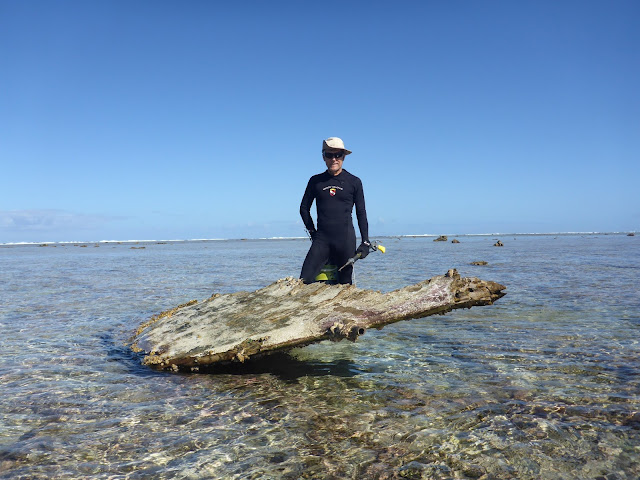
Grim discovery on the reef… some wreck…
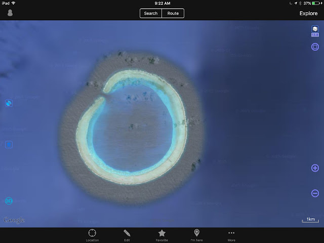
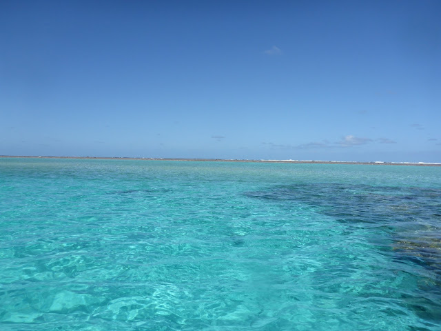
Like a giant eye staring from the ocean, its turquoise pupil dilated in spite of the glaring sun, its reef-streaked brown iris a warning to keep away, North Minerva is another mythical stop on the way to Fiji from New Zealand.  

An eye on the sky
There, we rendez-vou’d with the rest of the Sea Mercy Fleet,  for a little fun before starting our Recovery Mission in Vanua Balavu.

Entering the reef
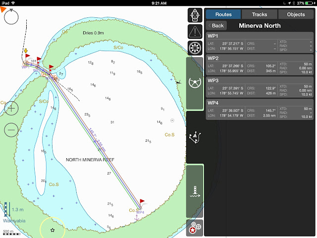
NAVIGATION NOTE – The pass is rather straightforward, easy in fair weather, but can get some pyramidal waves if the wind kicks up and the swell outside is large – Time the entrance for slack water.  There is a navigation beacon on the reef.
North Minerva Waypoints
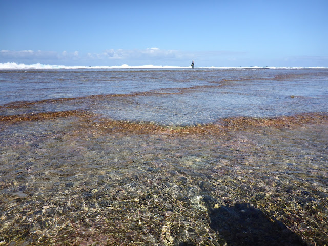
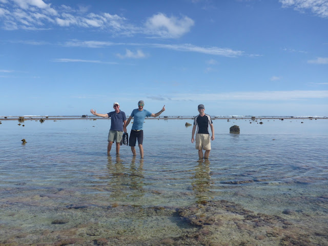
Unlike the South Minerva Reef, where access to the reef is rather difficult, one of the main attractions in North Minerva is actually to walk the reef. 

Looking out
And you stand there, at low tide, at the outer edge of the reef, ankle-deep in seawater, staring at the deep Pacific just a few yards away.    How small are we in the face of the ocean’s immensity!
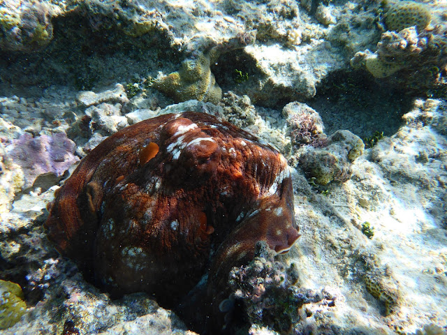
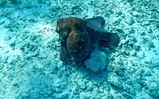
Spotting an octopus
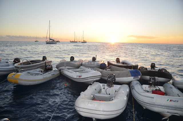
The water is not nearly as clear as in South Minerva, and the hunting is definitely not as good, but the anchorage is calmer, a perfect spot for a yacht gathering.  We took advantage of it to have our 1st Sea Mercy planning party on board DOMINO… and the entire anchorage joined in, Including John Martin’s Island Cruising Association yachts… some 18 dinghies tied to DOMINO’s stern a good 50 of us on board launched the cruising season!  A good start!
Let’s get this season started!
One awesome encounter: the motor yacht BROADSWORD, which we love, and in fact much prefer to Steve Dashew’s creations, much simpler, much cheaper… but more on this later.

Dominique, owner of Broadsword (left) and Dennis, the designer (right) walking the reef
Here are a few pix for your enjoyment!
Always a treat
Until next time…

Now, that’s what I call fishing… Off Vuata Ono, Souther Lau Group
dominomarie

SOUTH MINERVA REEF

The pass at South Minerva
MINERVA REEF – SOUTH
Friday May 13, 2016
23*56S – 179*06W  – Back to the West… and gained a day!
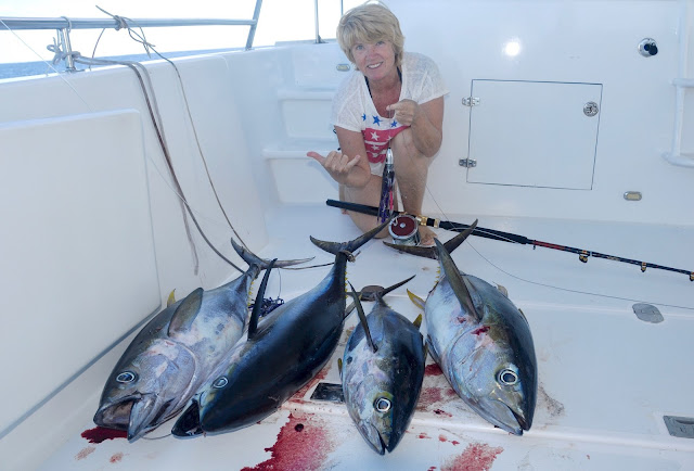
Friday the 13th!  What a day to arrive at one of the most isolated atolls in the world, under gloomy skies and drizzle!  The Minerva Reef.  It only took us 3 1/2 days to make the trip from 780 NM from Opua, always thankful to  our faithful John Deere engines who like to push us at 10 kts at 1000 rpm.  But on this trip, we had to slow down as not to arrive at Minerva in the evening.  So we travelled at 9 kts, at 900 rpm, burning 3 gallons per hour.  At sunrise, in front of the entrance of South Minerva Reef, we dropped the fishing lines overboard and were rewarded with an almost-instant double hookup of yellowfin tuna.  Kept one!
South Minerva Reef waypoints
NAVIGATION NOTE – There are 2 entrances: the north and the south channels of the western pass.  We took the north channel, at low tide (using the Raoul Island Tide Table,) with the reef very visible on starboard, straight through and across the lagoon to the anchorage close to the beacon; no problem spotting bommies.  The south channel is also a possibility, but one needs to take a sharp turn to port in order to avoid the rock in front of the pass.  Note that the light charted on top of the rock at the entrance no longer exists.  However, there is a working beacon on the east end of the reef, flashing 1” on, 3” off (messes up the view of the stars!!!)
With an eye on the weather, always!
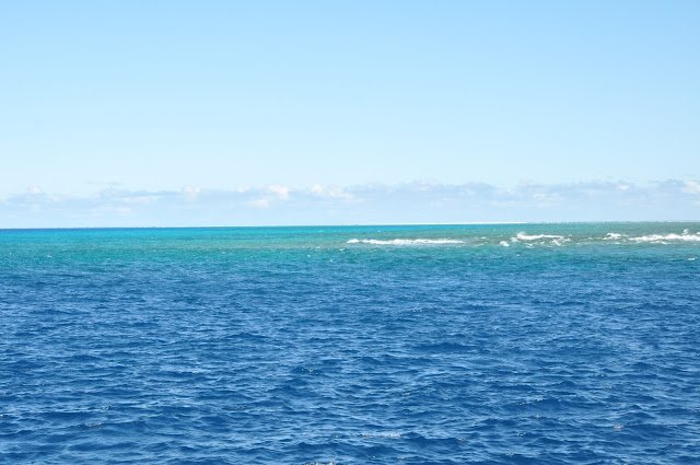
Here, there is no land; here, there are no trees; here, there are no birds.  There is only a ring of coral pounded by the long Pacific waves, their spewing foam the singular telltale of the reef’s presence and the primary clue to the mariner that this 5 x 3 miles obstruction to his progress exists.  How many yachts have crashed on this hidden reef?  Just a few years ago, a yachtie had not zoomed low enough into his electronic chart, had no idea that the reef was there and crashed into it, lost his yacht.
Checking in with Northland Radio and the Pacific Seafarers Net (14300 kHz @0300 UTC)
“Gin-clear water” is an expression I’ve heard before, but even in the Tuamotus I’ve not really, really seen it.  Well, this is gin-clear water.  The seas break over the reef and the water is filtered by the reef, with constant flow.  It wasn’t until the third day at anchor, once the clouds had dissipated, that we realized how special this place is.  Of course, we are the only boat for hundreds of miles around, which may seem a bit eery to you but is entirely satisfactory to us.  Anchored in 10 meters of water in the middle of the Pacific Ocean!

Sea Urchin
And the fauna?  Giant clams are really, really giant, the way we used to see them in Bora bora 25 years ago, and they are everywhere: just pick them up off the seafloor, try not to strain your back throwing them in the dinghy… 

Giant Clams heaven!
Lobsters are a bit trickier to find.  The first day, we found a bommie with at least 10 enormous spiny lobsters, the kind with long, white antennae, that are so skittish that they hide the moment they feel your disturbance in the water.  Sill, JP managed to shoot one (about 4 lbs!) but had all the trouble in the world getting it out of its hole, as it was clinging with amazing strength to the rocks, helped by its companion who clung to it till the end.  
“White Antenna” is the tip-off… 
The next day, we found another bommie with just 2 lobsters, again enormous, the kind with blue eyes and electric-blue cartilage at the base of the antennae, bumps all over the body (instead of spines).  That one decided to run back into its hole with JP’a arrow and it was a nail-biting experience to watch JP wedge his entire body in the hole to try to get his arrow back.  A good 20 minutes later, he got his arrow and lobster, another 4-lb beauty.  
“Blue Antenna” beauty
And today, we snorkeled for 4 hours, covering almost a mile of reef, and didn’t see a single antenna.  So, you see, don’t believe everything they say about this place, the lobsters don’t exactly crawl up your anchor chain.  Two lobsters in 20 man-hour of hunting is not a stellar performance!
Cleaning a giant clam: Muscle in sashimi, lips pressure-cooked for an hour, then in curry & coconut milk sauce
Sharks are pretty territorial here.  Although they check us out and usually leave us alone, these white tips let us know when they want us out of the water.  This morning, we dropped on a mama shark and her pup who were obviously hunting.  Within seconds, the mama was charging me, clear in her message that she didn’t want us around.  Like a good son, the little one followed suite and charged me too!  Pointing my slingshot in their direction, I swam quickly backwards to the dinghy, JP and I covering each-others’ backs, and we got away from the hunting territory.
Gin-clear water

Sunny days like today are spectacular. So clear is the water that I can see JP dive some 100 meters away and not have to look for his snorkel above water.  Coral blocks and canyons are home to yet new varieties of fish we had not seen before:  black Trevally, Dotted Sweetlips beyond 1m long, orange-gold and black Silver Sweetlips, all really tempting to hunt.  But with the shark activity and our fridge full of fish as it is, we don’t need to look for trouble.  So, we just enjoy.   
Spectacular coral beds
Moray Eels of all varieties are everywhere; I reckon I’ve seen at least 5 varieties in the last 2 days: giant Green, peppered, yellow-headed, snowflake, reticulated…  
Shells?  Disappointing… It seems that the giant clams have taken over all other forms of mollusks.  My collection will have to wait, but I managed to find 3 new varieties of cones and a tiny form of abalone.
 Dinner: lobster salad, tuna poki, Giant Clam
Diet?  Try this for lunch:  tuna poki, sashimi of yellowfin tuna and giant clams, lobster salad, white cabbage salad (token green stuff;) clam lips in curry-coconut sauce for dinner, lemon Basmati rice.  All good!
The anchorage has been uncomfortable.  Although it is rather calm at low tide, it is incredibly rolly as soon as the waves break over the reef.   From mid-tide, to high tide, to mid-tide, it’s 6 hours of rock and roll, and since the last 3 days have seen swells in the 3.5 meter range outside the reef, we have been rolling in our bed at night… not the most pleasant.
But it’s a small price to pay to see the biggest, most electric green flash ever!  And the stars!!! Shooting stars!!!   We are totally alone… and loving it!  It will be another 2 or 3 days yet before the rest of the Sea Mercy fleet catches up with us.
Till next time….

dominomarie 
VULAGA – FULANGA

VULAGA  (AKA FULAGA)


May 9, 2016
OPUA, NZ –  
This will be my last post for a while as we are leaving NZ this afternoon… HELLO Minerva Reef and Fiji.  So, I’m catching up on the last of the Laus we visited, the lovely Vulaga.

In the village of Navadamu, as in the other 2 villages, women gather clams and prepare them for shipping to Suva

 Hush… what was once the best kept secret in the Lau Group is now a source of delight for many cruisers.  There was a time when only a handful of yachts would head into the Easterlies and beat up to Vulaga, the southernmost of the islands of the Lau Group.  However, times have changed.  Last year, some 50 yachts visited this paradise.

Before fishing inside the lagoon, make sure that you are not dropping your line into a “tapu” area
Ask the Chief and your family during the SevuSevu ceremony

I won’t post pictures, because if you haven’t been there yet, you want to be surprised and delighted.  So, the only things I will talk about are the pass and the village anchorage.
Use Waypoints 7-11 to come in.
Tested by DOMINO (1.2 m  draft) and several other yachts in our group, with deeper draft
Before coming into the lagoon, it’s not a bad idea to call VULAGA RADIO on Ch.16.  Either Sarah (the nurse) or Sikelli (her husband) or Joe (Sikelli’s brother) will respond and confirm the tide time.

Plenty of room to anchor at the village.
Go to shore immediately, walk 20 minutes up the trail, and bring your yangona!!!!
The pass is pretty tricky, a dogleg, and a bit narrow.  Coming in, stay close to the black rock on port, as the reef is pretty shallow on starboard.   Best time to go through (check tide table at MOALA): About the same time as high tide and  almost 2 hours after low tide.  We got at the pass early (in both directions) and waited for slack, but this is about right.


Once inside the lagoon, it’s pretty smooth sailing, as long as you keep a good lookout.  The village anchorage is in 5-7 meters, good sand, very good holding.  To dinghy ashore, be prepared to shuttle your little craft back and forth or, better, consider kayaking.
Either way, the villagers are absolutely delightful.  Go do your SevuSevu ceremony and the Chief will assign you a family.  Make sure you go to church with your family on Sunday and enjoy the singing!  ‘nuff said!, you need to discover the rest for yourself.
Till next time….

dominomarie
Budd Reef

BUDD REEF, just east of Rabi.We waited in Albert Cove (Rabi) and then crossed at the Texas PassEntered by the west passage We visited Budd Reef in June 2015.  We had high hopes to snorkle the reef and hire a local to take us to Cobia Island w…

VANUA BALAVU (Part 2)

VANUA BALAVU (PART 2)


EAST AND SOUTHEAST
Opua (NZ) – May 6, 2016 –   This is the second installment of my compendium of navigation notes on the Lau Groups, Fiji.
*** Disclaimer – This is a collection of waypoints, anchorages and routes that I have gathered from other cruisers, websites, guides and seminars I attended.  DOMINO has not navigated in the Eastern lagoon of Vanua Balavu and we have not tested these waypoints.  Furthermore, in the aftermath of Cyclone Winston, the seafloor may have been littered with debris and the anchorages may have been altered.  We recommend caution and a sharp lookout, daytime navigation in good conditions only! ***


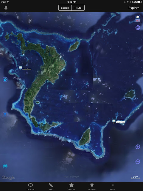
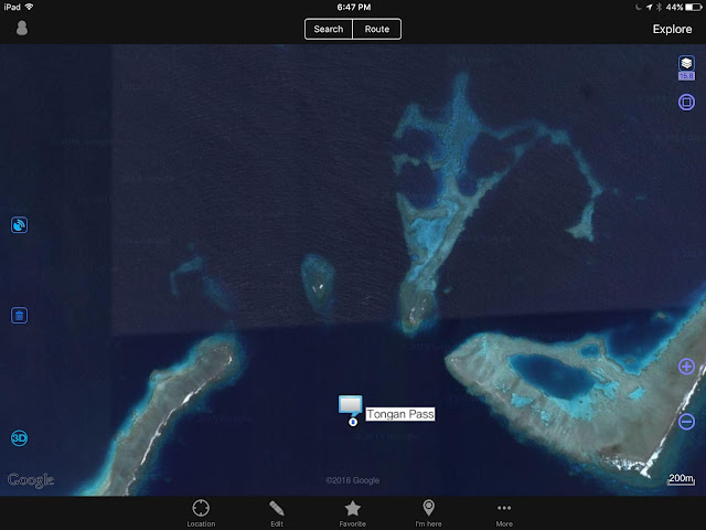
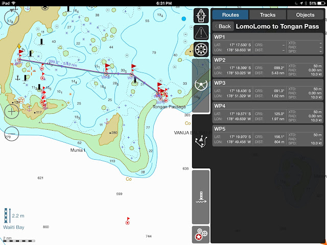
1 – The Tongan Pass  –  This is the SE pass into Vanua Balavu and the most direct route to Lomaloma.  A reef bisects the entrance of the pass, so cruisers have to go east or west of that reef.  Although I have waypoints for both sides, I have more reports for the west channel.

Tongan Pass – The route entered is for the western channel… The eastern channel is possible as well
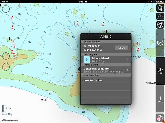
2 – Munia Island Anchorage – A good anchorage before or after transiting through the Tongan Pass.
Munia Island Anchorage point
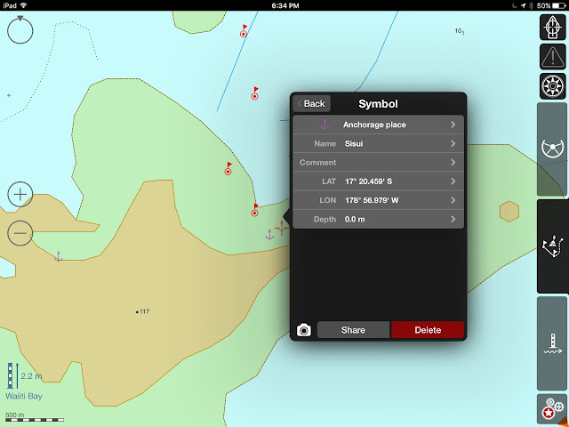
3 – Susui Island – There are 2 anchorages possible – 
Sisui 
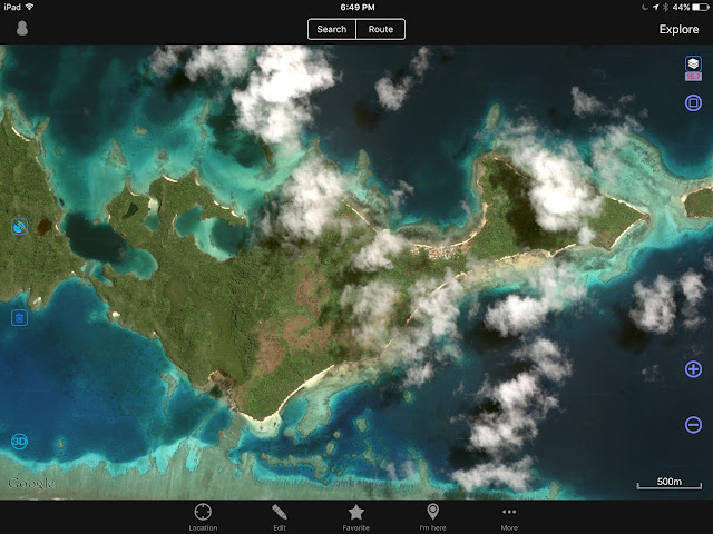
4 – The Hidden lagoon – Possibly, the locals at Susui can give cruisers directions to the Hidden lagoon.

Susui Island: Anchorage and Hidden lagoon


Sisui – Hidden Lagoon Anchorage Point – unsure if the lagoon is accessible
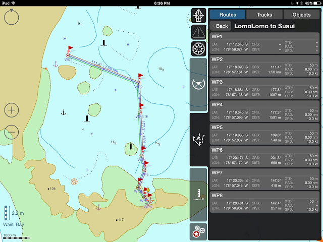
5 – Lomaloma to Susui

Lomaloma to Sisui

Lomaloma to Sisui, and Munia Island

6 – Tongan Pass to Lomaloma

Tongan Passage to Lomaloma

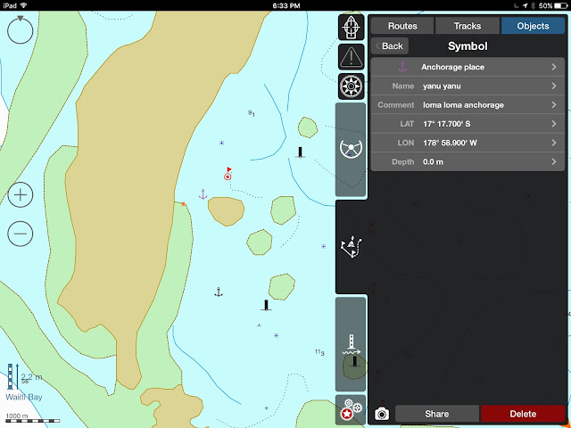
7 – Lomaloma anchorage – 

YanuYanu = Lomaloma

8 – Mavana – 
Mavana Anchorage

9 – Lomaloma to Mavana –   
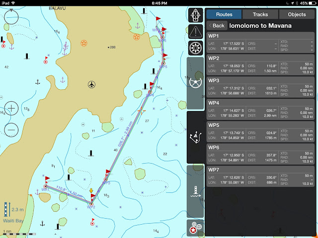
Lomaloma to mavana
Again, we have not experienced these anchorages and we expect they have most suffered from a 30’ surge and 165 mph winds.  I wish I had recent Google satellite pictures to share, but all of these are pre-Winston.  
In any case, be careful!
Until next time

dominomarie

VANUA BALAVU (Part I)

VANUA BALAVU – West and North
Vanua Balavu, Northern Lau Group, Fiji
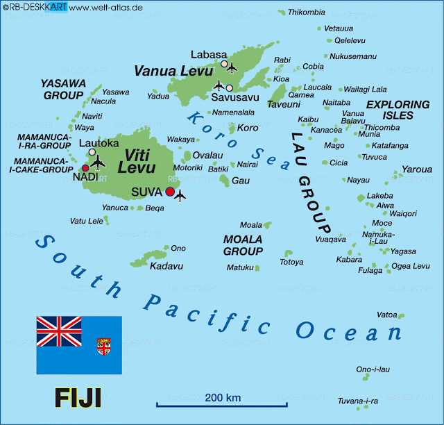
3 passes: Qiliqili to the NW, Adavaci to the W, and Tongan Pass to the SE
*** Disclaimer  — These navigation notes have been gathered from many sources as well as from our own experience.  After Cyclone Winston, we can expect that many navigation beacons and marks have disappeared.  We can also expect that, in some places, the coral beds have been damaged and perhaps re-arranged.  The litter and rubble in the anchorages is unknown.  Use the provided information using your own discretion, and keep a sharp lookout.  Do not navigate inside the lagoons and passes in poor visibility.  ***

Note that DOMINO draws 1.2 meter (4′) – 

QILIQILI PASS (NW PASS)

Qiliqili Pass (NW end)

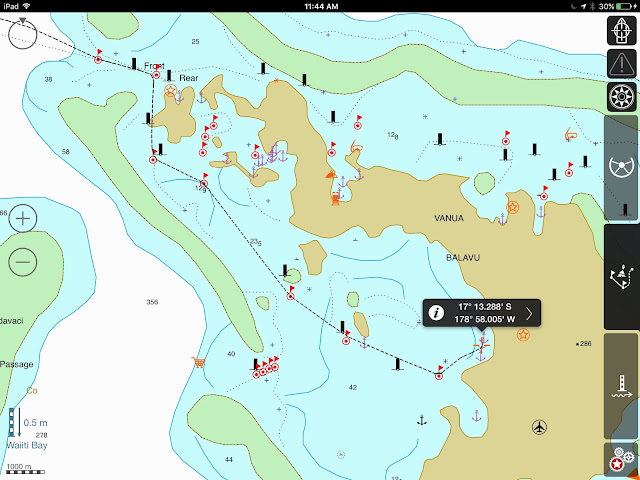
  • Photo 1 – Vanua Balavu – General Location of Northwest pass entrance (Qiliqili) 
(NOTE – iSailor files may still be available for download on my Google Drive )


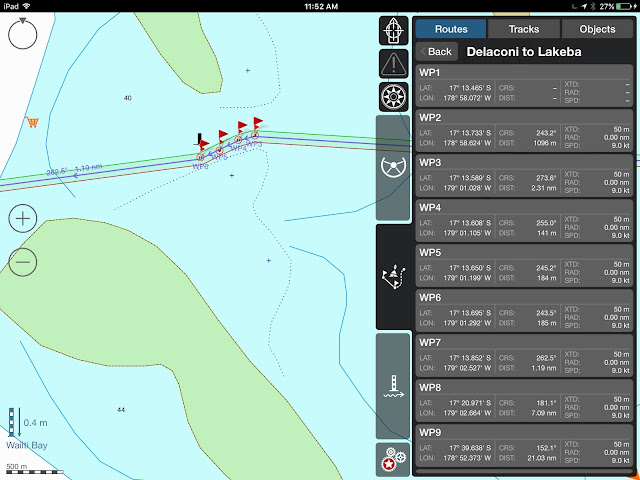
  • Photo 2 – Vanua Balavu NW Pass (Qiliqili) to Delaconi village – Waypoints 3-11


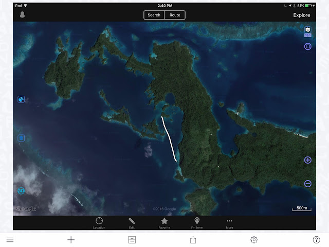
  • Photo 3a – Vanua Balavu – Domino’s track from Qiliqili Pass to Delaconi anchorage

** CAUTION **  Be mindful of the small reefs when approaching the village  –  The holding at Delaconi village is marginal, lots of rocks and rubble.  It is rolly in any SW to NW condition.   Then, a better anchorage can be found just west of the airstrip.
  • Photo 3b – Delaconi – Airstrip anchorage

A bit of a dingy ride to the village, but the “airstrip” anchorage is popular in westerly conditions
Getting to shore by dinghy, look for the small opening in the reef, not wide but present at low tide… not no much worry at high tide. 
ADAVACI PASS (SW PASS)
  • Photo 4 – Vanua Balavu – Adavaci Pass (SW) – Waypoints 1-7 – This is a straight shot west of Delaconi Village.  One of the reasons while the anchorage is rolly in westerly conditions, but a quick way to get out.  At any rate, only advisable in calm and clear conditions as there are bits of reef to be avoided.
Photo 5 – Vanua Balavu Adavaci Pass (SW) – Detail – WP 3-6
                 (The orange food cart denotes good fishing!!!)


BAY OF ISLANDS
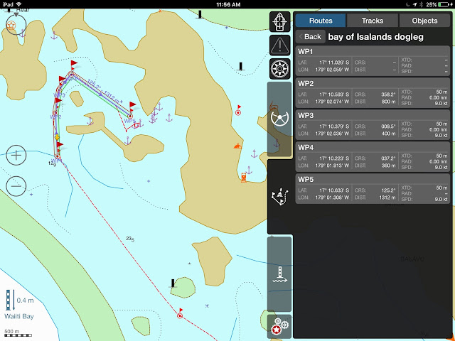
When the anchorage in Delaconi gets too rolly and windy, the Bay of Islands (BoI) offers good protection from most directions.  Some yachts may find it hard to anchor in the 17-20-meter depth, but the holding is good.  With a bit of poking around, you can find shallower spots.
To get to the BoI anchorages from Delaconi, we found it safer to track back towards Qiliqili Pass and enter the “dogleg” track.  Always trolling a couple of lines, always catching a Sierra (Spanish Mackerel) or two!
We’ve seen some yachts take the shorter “inside passage”, but only with excellent visibility and 2 lookouts on deck, and it’s a gutsy passage I would’t try.  S/Y Rewa did it and we watched them hesitate and backtrack between rocks and reefs! 
The “Inside Passage” to the BoI – Not recommended!
Photo 6 – Bay of Islands “Dogleg” and Domino’s track

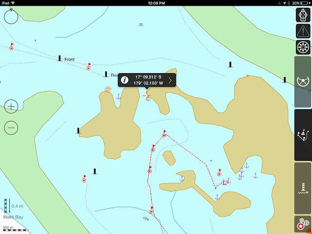
Photo 7 – Bay of Islands Anchorages – There are many of them in The “Swimming Pool”, but there is no need to be on top of each other.  It’s a wonderful area to explore, find the caves, look for the fruit bats, and kayak around.  The nook at the northern end is a good overnight spot while waiting for good conditions to exit.  Note that the “Front” and “Rear” beacons are most likely gone.


BAY OF ISLANDS TO MBAVATU (PLANTATION) 
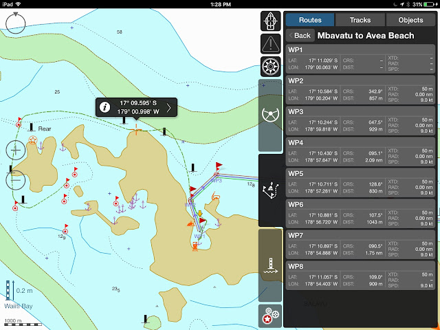
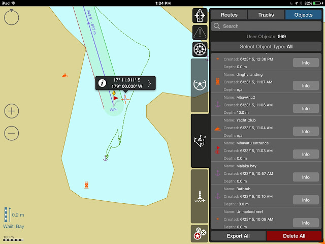
Photo 8 – DOMINO’s track – to enter Mbavatu, use Wpts. 2 and 1
** Note that at the northern end of the island, the reef extends farther out than on the chart.  Keep a sharp lookout… most of the marks may have disappeared ***


Photo 9 – Rounding over the top… notice the reefs in the north channel… careful… only do on a clear day!
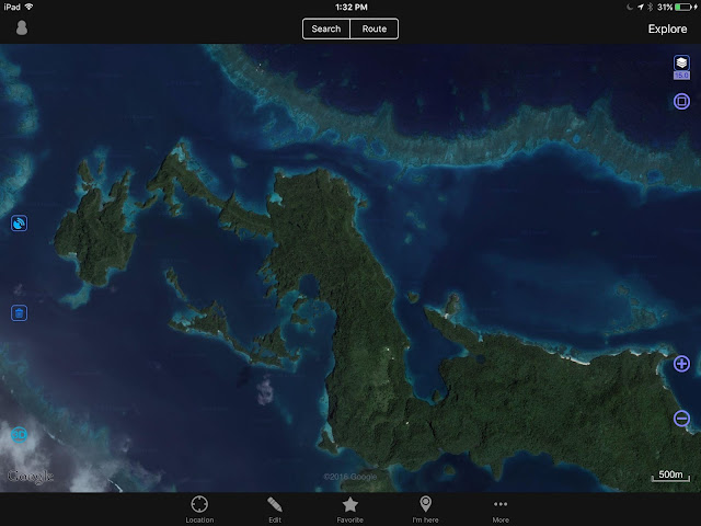
OVITALMAP satellite photo

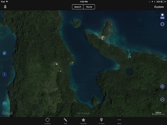
Photo 10 – Mbavatu Harbor – There are several anchorages, but the closer you get to shore, the more likely you are to encounter rocks.  Also, the anchorage in the NE hook has been proven to get rolly as the rocky shores reverberate and amplify any kind of wave action.  We just prefer to anchor smack dab in the middle!  The “Yacht Club” moorings on the Western end may be gone, the Yacht Club building too… The Landing is at the bottom Western side of the bay.  Just walk up the hill and you should get to the coconut oil plant, or what’s left of it.  Higher yet is the coconut plantation and workers’ village… if still standing.

Photo 11 – Mbavatu Harbor
OVITALMAP


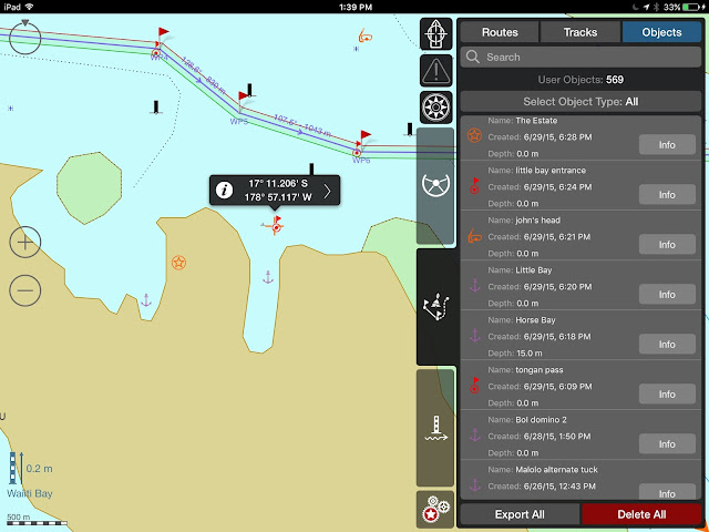
Photo 12 – Horse Bay and Little Bay

Horse Bay, Little Bay, The Estate and other waypoints

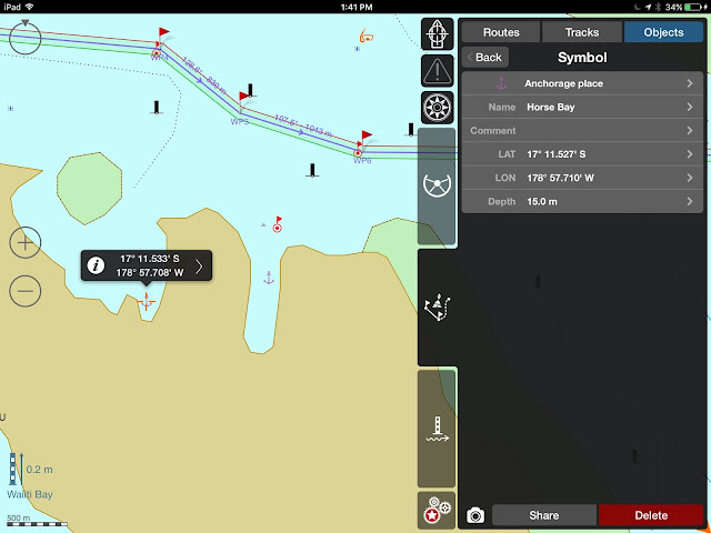
Photo 13 – Horse Bay “The Estate” was a pig farm.  What is left, we do not know.  It is possible to anchor – 17*11.527S – 178*57.710 W


Photo 14 – Little Bay – It is possible to enter Little Bay – It used to have good Internet, in straight line from the phone tower, but who knows what happened with the comm. tower?  Very secure anchorage, not much room for more than 1 boat.


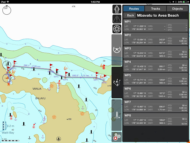
Photo 15 – Mbavatu to Avea – Again, careful of the reef, especially around WP7 – 


Photo 16 – Avea Anchorage – Just north of the village, the anchorage can be rolly, and we only stayed one night.  The village was so low-lying it’s probably gone. 


There is good snorkeling just north of the anchorage and Soggy Paws reported good diving just through the pass 
( WPs: dinghy pass Inner 17*10.349S 178*54.429W
            dinghy pass Outer 17*10.315S 178*54.447W
            Dive spot 17*10.239S 178*54.504W ) What is left?
Photo 17 – Avea – The village is located at the SW tip of the island.


till next time

dominomarie

New Zealand to Fiji


NEW ZEALAND TO FIJI
After last cruising season in Fiji (May to November) and our forced migration to New Zealand to repair hull damage (a reef scratched our bottom!), we were planning on spending another season lazing around the coasts of Vanua Levu (Fiji’s North Island), diving the splendid reef of the Somosomo Straight.  But Winston changed all that.

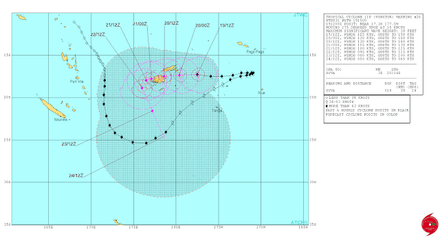
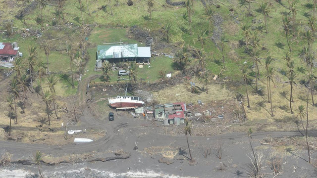
On February 20th, Cyclone Winston —A Cat. 5 Cyclone, the strongest cyclone to hit the South Pacific on record — slammed into Fiji.  After skirting Fiji as a Cat. 2 cyclone, Winston travelled east toward Tonga, then made a 180 degree turn and tracked back toward Fiji, gathering strength.  It slammed into Vanua Balavu (Northern Lau Group), unleashing winds at 165 mph and even a recorded gust at 190 miles/hour (306 km/h) and created a 30-foot (10 meter) surge that swamped roads, homes, schools, entire villages.  
An amazing track: Winston travelled SSE, then NE, then tracked back full West…

Winston continued its track west at 25 Kts, roaring over Taveuni and slamming into Savu Savu with sustained winds recorded at 145 mph (230 km/h.)  Of the 52 boats in Savu Savu harbor, only 7 remained at anchor or on their moorings.  All others were either washed ashore (some washed up 200 yards inland) or sunk.  Our friends on Kaija’s Song lived to tell the horror of that night.  Thanks to rapid help, Savu Savu is recovering; so is the mainland of Vanua Levu.  Taveuni, accessible through its air strip, is also receiving help.  

In Savu Savu, utter destruction!

But what of the Northern Laus and Vanua Balavu?  Isolated, absolutely devastated, Vanua Balavu and its surrounding islands are a long way from recovery.  Some islands have not had any damage assessment yet.
The Lau Group, especially the islands in the north, Vanua Balavu and its surrounding isles were hardest hit
We wanted to do something for the Fijians in the Northern Laus, who have welcomed us so warmly last season.  But how to help?  In comes SEA MERCY, a 4-year old relief organization made of volunteer cruisers.  Strong of their experience in Vanuatu last year (Cyclone PAM devastated some areas of Vanuatu,) SEA MERCY is organizing a fleet of boats to spread all around Fiji and bring help to isolated villages.  Our particular group, DR2A (Disaster Recovery Group 2A) is awaiting a weather window to head straight for Vanua Balavu where Sea Mercy has organized an exceptional clearance from the customs and immigration officials, though VB is not a normal port of entry.  
In Vulaga (Southern Laus) exporting clams is a sustainable commerce
Several more groups have formed in Opua (New Zealand) and will leave either for Denarau (South Island of Viti Levu) or Savu Savu (North Island of Vanua Levu), while other vessels will arrive from other points (Australia, French Polynesia) and join the Sea Mercy fleet for the season.  In all, some 40 yachts are involved in this massive recovery effort.
Weather GRIB on Predic Wind
While we are waiting for the large stationary high pressure system currently hovering over New Zealand to dissipate, and for weather window to open (looks like a May 11th departure), we are getting the boat’s communications ready, gathering waypoints and alternate routes with a stop-over at Minerva Reef.
COMMUNICATIONS
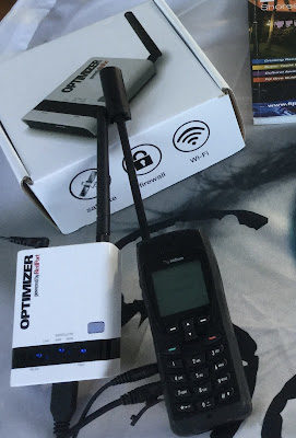
Our new setup: Iridium 5555 + Optimizer
  • IRIDIUM + OPTIMIZER  –  The latest toy from Iridium is the IRIDIUM GO, a satellite WiFi hotspot with integrated GPS.  But since our IRIDIUM 9555 handset is in excellent working order, we were not on the market for a new satphone.  Enter the OPTIMIZER by RedPort, a little gizmo that plugs into the IRIDIUM handset and turns it into a WiFi hotspot.  It comes with the X-Gate mail program and works seamlessly with our iPads and Macs.  
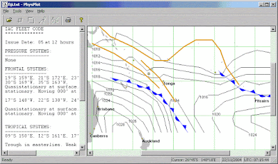
PHYSPLOT: Our old set up: still valuable information, still will use it
  • Why would we want this anyways?  Isn’t our old system of Windows-based weather GRIBs and Physplot Fleet Code plotting enough?  Could be, and we are definitely keeping that option as backup.
   For the last 2 years, while on passages, our daily mail (using X-Gate Mail) requests to saildocs under this setup have been- (and this is our back-up option now)
subject: (blank)
body:  send fleet.nadi
           send gfs:10S,40S,165E,165W|2,2|24,48,72,96|
( * more saildocs GRIBS available at  gribinfo@saildocs.com
   * for a list of saildocs documents available, send an email
   subject: (blank)
   body: send index
The robot responds within seconds and we drag the “Fleet NADI” email onto the Physplot  program (more on the Pangolin Website) to see the current pressure chart for the South Pacific.
As for the “GRIB” email, all we have to do is open the attachment and it opens itself into the GFS reader.
A bit cumbersome, but it works well enough… now, for the new and improved and FASTER (saves minutes on the IRIDIUM plan)…
  • PREDICT WIND – The new rage in passage weather routing, PREDICT WIND rocks!  Fully integrated with the IRIDIUM GO (or IRIDIUM + OPTIMIZER) and the X-Gate Mail, Predict Wind offers offshore weather routing and GRIB files in quick download formats.  Just prepare the email off-line using the Predict Wind Offshore App, fire-up the IRIDIUM hotspot, and BANG! in a matter of seconds you have your GRIB file, pressure map, and updated routing info.  You can enter the parameters of your boats for maximum efficiency or comfort, and tweak your “POLARS” to your liking.  Pretty nifty!
      

         MET BOB –  For years, we have subsribed to METBOB’s weekly weather report.  Once again, Bob McDavitt is helpful as he is analyzing the weather for our group’s passage!


  • Good old HAM Radio – 

  •  PACIFIC SEAFARERS NET (14300 kHz @0300 UTC) – Still our favorite.  The many operators and relays ensure the clearest possible communication with Americans.  No weather info unless requested. Track our progress on the Pangolin YOTREPS

  • GULF HARBOR RADIO (8752 kHz @ 1915 UTC) – David and Patricia run weather and roll call, a nice volunteer service.  I’ve had difficulty understanding the Kiwi accent, however, and I’ve found the net to run longer than comfortable.  Track us on the AIS tracker. 
  • SOUTH CROSS NET (8191 kHz  @ 2000 UTC) – A small group of cruisers between NZ and Fiji share their positions and weather info.
  • NORTHLAND RADIO (6227 kHz @ 0610 UTC) – Private Radio station in Russell

OVITALMAP – Faster download, better resolution than SAS Planet and Open CPN/Google
Amazing to watch your boat navigate into a harbor or through the reef!
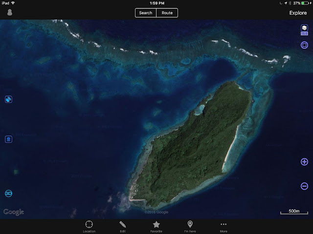
CHART PLOTTING – The apps for iPad and Mac keep popping up!  Try OVITALMAP for iPad.  The app uses the GPS location of your iPad to locate the boat on a satellite photo.  You can choose either Google or Bing – Since we don’t have broadband Internet on passages, we cache images of all intended destinations before we leave home port.  Unlike the SAS Planet or Open CPN programs that ask you to cache the downloaded images, OVITALMAP automatically saves all images as you explore the area.  It’s lightning-fast!  Zoom in, zoom out, it’s all saved!  One caveat: check on the storage volume of you iPad!
I love iSailor!  so easy to share routes and tracks with other users!
I can just take a photo or export to my Google Drive for all to use!
TEST IF IT WORKS FOR YOU  at My Drive….
For navigation, we still use the ship’s Navnet system (although it’s very inaccurate in the Lau Group), Navionics for iPad, and (my favorite) iSailor for iPad.  Do we have enough info?  Right!  The danger is now that we spend too much time looking at the screens, not enough time looking out the window!!! BEWARE!!!

A note:  The Island Cruising Association (Opua, NZ) has published an app to help cruisers with their Fiji travels, with some good weather planning info, some commonly travelled routes and waypoints, a cruising guide app worth a look.


CRUISING GUIDES – For Fiji, we have used Soggy Paws’ Compendium, and scores of blogs and notes gleaned from the Internet.  There is precious little info on the Lau Group.  For this reason, I will dedicate the next blog to the Laus, routes and waypoints.
The Fijians have made us feel at home.  We are ready to rebuild their homes!
CONTRIBUTORS –   I would be remiss if I didn’t acknowledge the locals and internationals who are helping our Sea Mercy fleet.  Particular thanks go to
– the Island Cruising Association for sharing their knowledge and meeting space.
ITM  for providing us with shelter building kits and solar lights
BURNSCO  for loading us with fiberglassing kits and fishing supplies
METBOB for his weather routing
The Satphone Store for helping us solve our communication issues
The Wirie  for keeping our WiriePro in good working order and updating its software

… and Jonathan on S/V Chez Nous, our tireless leader and coordinator!

We are ready to go! 
Until then…

dominomarie

LAst days of summer

April 27, 2016Somewhere off the Tutukaka Coast(Rounding Bream Head, at Whangarei)We left Whangarei this morning, after a short visit to California.  DOMINO, safely docked at MArsden Cove Marina, was itching for a ride, her hulls slightly slimed. &…

Great Barrier Delight

Port Fitzroy & Kairara BayApril 18, 2016 – Marsden Cove Marina, Whangarei, New ZealandPOST #366  — After almost six months in New Zealand, we had a few weeks off before going back to Fiji and where did we decide to go?  Great B…